You are here: Home > Network List > TA - USArray Transportable Network (new EarthScope stations) Stations List
> Station T40A Mansfield, MO, USA > Earthquake Result Viewer
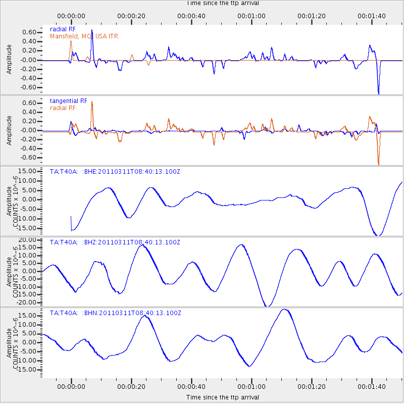
T40A Mansfield, MO, USA - Earthquake Result Viewer
*The percent match for this event was below the threshold and hence no stack was calculated.
| Earthquake location: |
Near East Coast Of Honshu, Japan |
| Earthquake latitude/longitude: |
38.0/142.7 |
| Earthquake time(UTC): |
2011/03/11 (070) 08:27:51 GMT |
| Earthquake Depth: |
43 km |
| Earthquake Magnitude: |
6.0 MB |
| Earthquake Catalog/Contributor: |
WHDF/NEIC |
|
| Network: |
TA USArray Transportable Network (new EarthScope stations) |
| Station: |
T40A Mansfield, MO, USA |
| Lat/Lon: |
37.15 N/92.52 W |
| Elevation: |
399 m |
|
| Distance: |
89.5 deg |
| Az: |
40.99 deg |
| Baz: |
319.579 deg |
| Ray Param: |
$rayparam |
*The percent match for this event was below the threshold and hence was not used in the summary stack. |
|
| Radial Match: |
77.120834 % |
| Radial Bump: |
321 |
| Transverse Match: |
29.11362 % |
| Transverse Bump: |
284 |
| SOD ConfigId: |
356183 |
| Insert Time: |
2011-08-13 13:27:44.272 +0000 |
| GWidth: |
2.5 |
| Max Bumps: |
400 |
| Tol: |
0.001 |
|
Signal To Noise
| Channel | StoN | STA | LTA |
| TA:T40A: :BHZ:20110311T08:40:13.100Z | 2.6242166 | 1.2039799E-5 | 4.5879597E-6 |
| TA:T40A: :BHN:20110311T08:40:13.100Z | 0.8342348 | 3.9043125E-6 | 4.6801124E-6 |
| TA:T40A: :BHE:20110311T08:40:13.100Z | 0.32901424 | 2.181596E-6 | 6.6307034E-6 |
| Arrivals |
| Ps | |
| PpPs | |
| PsPs/PpSs | |


