You are here: Home > Network List > TA - USArray Transportable Network (new EarthScope stations) Stations List
> Station R31A Burdett, KS, USA > Earthquake Result Viewer
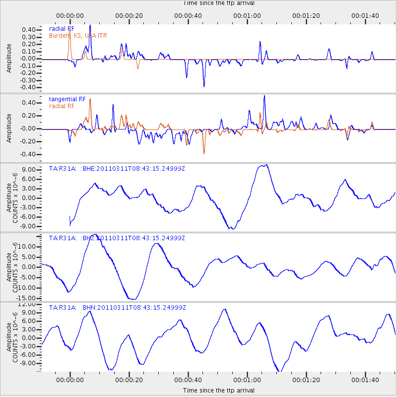
R31A Burdett, KS, USA - Earthquake Result Viewer
*The percent match for this event was below the threshold and hence no stack was calculated.
| Earthquake location: |
Near East Coast Of Honshu, Japan |
| Earthquake latitude/longitude: |
37.5/141.2 |
| Earthquake time(UTC): |
2011/03/11 (070) 08:31:09 GMT |
| Earthquake Depth: |
37 km |
| Earthquake Magnitude: |
6.0 MB |
| Earthquake Catalog/Contributor: |
WHDF/NEIC |
|
| Network: |
TA USArray Transportable Network (new EarthScope stations) |
| Station: |
R31A Burdett, KS, USA |
| Lat/Lon: |
38.29 N/99.53 W |
| Elevation: |
667 m |
|
| Distance: |
86.1 deg |
| Az: |
43.459 deg |
| Baz: |
315.936 deg |
| Ray Param: |
$rayparam |
*The percent match for this event was below the threshold and hence was not used in the summary stack. |
|
| Radial Match: |
72.226814 % |
| Radial Bump: |
375 |
| Transverse Match: |
65.53287 % |
| Transverse Bump: |
400 |
| SOD ConfigId: |
356183 |
| Insert Time: |
2011-08-13 14:38:57.310 +0000 |
| GWidth: |
2.5 |
| Max Bumps: |
400 |
| Tol: |
0.001 |
|
Signal To Noise
| Channel | StoN | STA | LTA |
| TA:R31A: :BHZ:20110311T08:43:15.24999Z | 3.1737537 | 7.3324495E-6 | 2.3103398E-6 |
| TA:R31A: :BHN:20110311T08:43:15.24999Z | 1.0946376 | 4.1498615E-6 | 3.7910825E-6 |
| TA:R31A: :BHE:20110311T08:43:15.24999Z | 1.5048498 | 4.386532E-6 | 2.9149303E-6 |
| Arrivals |
| Ps | |
| PpPs | |
| PsPs/PpSs | |


