You are here: Home > Network List > TA - USArray Transportable Network (new EarthScope stations) Stations List
> Station Y37A Hugo, OK, USA > Earthquake Result Viewer
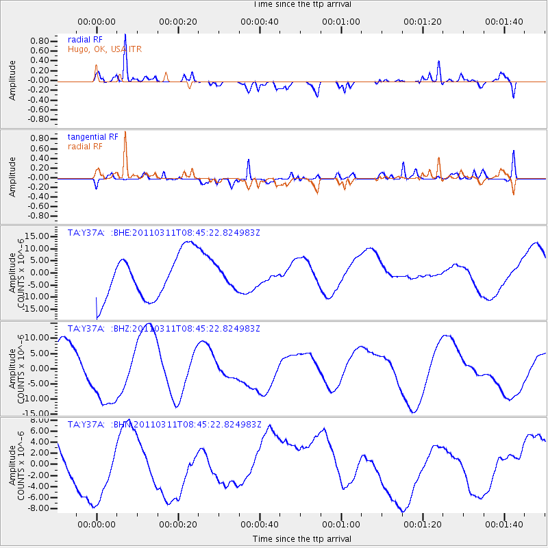
Y37A Hugo, OK, USA - Earthquake Result Viewer
*The percent match for this event was below the threshold and hence no stack was calculated.
| Earthquake location: |
Near East Coast Of Honshu, Japan |
| Earthquake latitude/longitude: |
39.1/143.0 |
| Earthquake time(UTC): |
2011/03/11 (070) 08:33:00 GMT |
| Earthquake Depth: |
28 km |
| Earthquake Magnitude: |
6.0 MB |
| Earthquake Catalog/Contributor: |
WHDF/NEIC |
|
| Network: |
TA USArray Transportable Network (new EarthScope stations) |
| Station: |
Y37A Hugo, OK, USA |
| Lat/Lon: |
33.98 N/95.62 W |
| Elevation: |
165 m |
|
| Distance: |
89.3 deg |
| Az: |
45.174 deg |
| Baz: |
318.413 deg |
| Ray Param: |
$rayparam |
*The percent match for this event was below the threshold and hence was not used in the summary stack. |
|
| Radial Match: |
73.02773 % |
| Radial Bump: |
400 |
| Transverse Match: |
56.04512 % |
| Transverse Bump: |
400 |
| SOD ConfigId: |
356183 |
| Insert Time: |
2011-08-13 16:26:35.054 +0000 |
| GWidth: |
2.5 |
| Max Bumps: |
400 |
| Tol: |
0.001 |
|
Signal To Noise
| Channel | StoN | STA | LTA |
| TA:Y37A: :BHZ:20110311T08:45:22.824983Z | 2.1644058 | 1.1114617E-5 | 5.135182E-6 |
| TA:Y37A: :BHN:20110311T08:45:22.824983Z | 1.9738653 | 6.858637E-6 | 3.4747238E-6 |
| TA:Y37A: :BHE:20110311T08:45:22.824983Z | 0.4120604 | 3.81808E-6 | 9.2658265E-6 |
| Arrivals |
| Ps | |
| PpPs | |
| PsPs/PpSs | |


