You are here: Home > Network List > TA - USArray Transportable Network (new EarthScope stations) Stations List
> Station H37A Dierke Farm, Cannon Falls, MN, USA > Earthquake Result Viewer
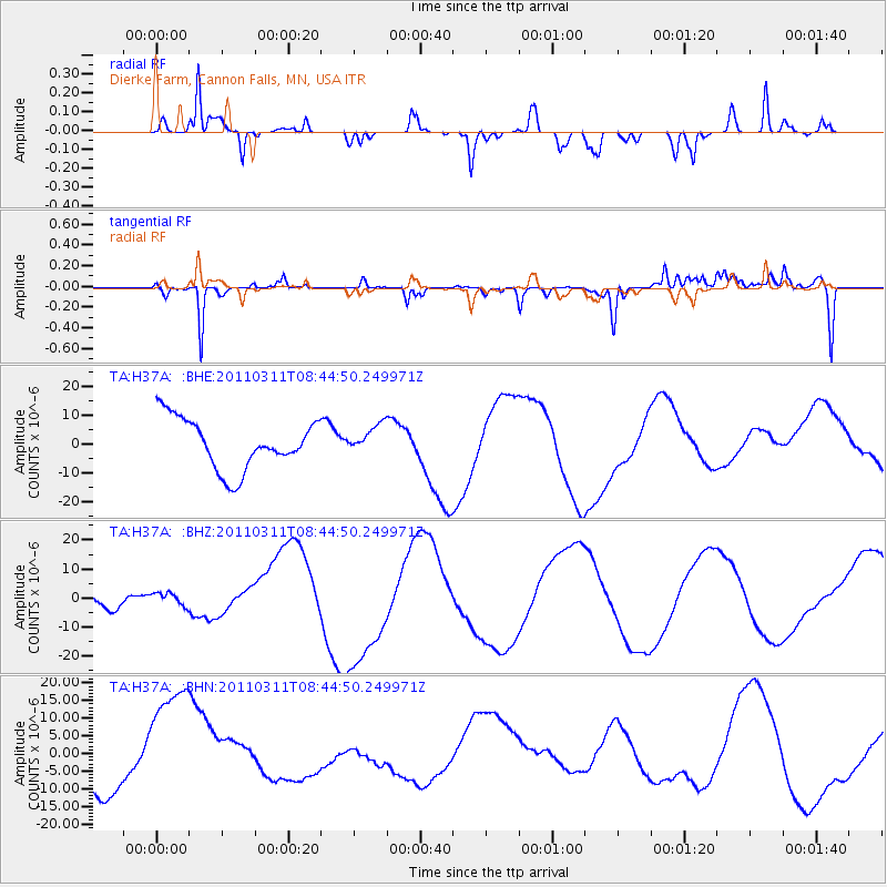
H37A Dierke Farm, Cannon Falls, MN, USA - Earthquake Result Viewer
*The percent match for this event was below the threshold and hence no stack was calculated.
| Earthquake location: |
Near East Coast Of Honshu, Japan |
| Earthquake latitude/longitude: |
39.1/143.0 |
| Earthquake time(UTC): |
2011/03/11 (070) 08:33:00 GMT |
| Earthquake Depth: |
28 km |
| Earthquake Magnitude: |
6.0 MB |
| Earthquake Catalog/Contributor: |
WHDF/NEIC |
|
| Network: |
TA USArray Transportable Network (new EarthScope stations) |
| Station: |
H37A Dierke Farm, Cannon Falls, MN, USA |
| Lat/Lon: |
44.58 N/92.92 W |
| Elevation: |
321 m |
|
| Distance: |
82.6 deg |
| Az: |
36.623 deg |
| Baz: |
319.519 deg |
| Ray Param: |
$rayparam |
*The percent match for this event was below the threshold and hence was not used in the summary stack. |
|
| Radial Match: |
58.74367 % |
| Radial Bump: |
212 |
| Transverse Match: |
84.883224 % |
| Transverse Bump: |
264 |
| SOD ConfigId: |
356183 |
| Insert Time: |
2011-08-13 16:39:08.403 +0000 |
| GWidth: |
2.5 |
| Max Bumps: |
400 |
| Tol: |
0.001 |
|
Signal To Noise
| Channel | StoN | STA | LTA |
| TA:H37A: :BHZ:20110311T08:44:50.249971Z | 0.5995479 | 2.978741E-6 | 4.9683117E-6 |
| TA:H37A: :BHN:20110311T08:44:50.249971Z | 3.850122 | 2.0578389E-5 | 5.3448666E-6 |
| TA:H37A: :BHE:20110311T08:44:50.249971Z | 0.57707906 | 4.9918626E-6 | 8.650223E-6 |
| Arrivals |
| Ps | |
| PpPs | |
| PsPs/PpSs | |


