You are here: Home > Network List > TA - USArray Transportable Network (new EarthScope stations) Stations List
> Station K37A Belmond, IA, USA > Earthquake Result Viewer
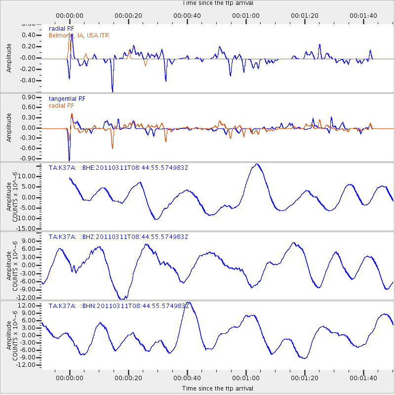
K37A Belmond, IA, USA - Earthquake Result Viewer
*The percent match for this event was below the threshold and hence no stack was calculated.
| Earthquake location: |
Near East Coast Of Honshu, Japan |
| Earthquake latitude/longitude: |
39.1/143.0 |
| Earthquake time(UTC): |
2011/03/11 (070) 08:33:00 GMT |
| Earthquake Depth: |
28 km |
| Earthquake Magnitude: |
6.0 MB |
| Earthquake Catalog/Contributor: |
WHDF/NEIC |
|
| Network: |
TA USArray Transportable Network (new EarthScope stations) |
| Station: |
K37A Belmond, IA, USA |
| Lat/Lon: |
42.77 N/93.64 W |
| Elevation: |
365 m |
|
| Distance: |
83.7 deg |
| Az: |
38.212 deg |
| Baz: |
319.212 deg |
| Ray Param: |
$rayparam |
*The percent match for this event was below the threshold and hence was not used in the summary stack. |
|
| Radial Match: |
57.473682 % |
| Radial Bump: |
378 |
| Transverse Match: |
51.43232 % |
| Transverse Bump: |
400 |
| SOD ConfigId: |
356183 |
| Insert Time: |
2011-08-13 16:40:12.112 +0000 |
| GWidth: |
2.5 |
| Max Bumps: |
400 |
| Tol: |
0.001 |
|
Signal To Noise
| Channel | StoN | STA | LTA |
| TA:K37A: :BHZ:20110311T08:44:55.574983Z | 0.3894677 | 2.464412E-6 | 6.327642E-6 |
| TA:K37A: :BHN:20110311T08:44:55.574983Z | 0.86574847 | 5.2836735E-6 | 6.1030123E-6 |
| TA:K37A: :BHE:20110311T08:44:55.574983Z | 2.885512 | 9.275983E-6 | 3.2146747E-6 |
| Arrivals |
| Ps | |
| PpPs | |
| PsPs/PpSs | |


