You are here: Home > Network List > US - United States National Seismic Network Stations List
> Station EGMT Eagleton, Montana, USA > Earthquake Result Viewer
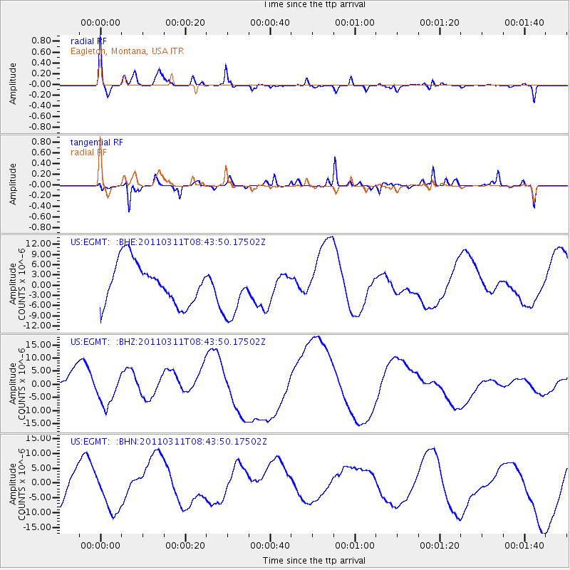
EGMT Eagleton, Montana, USA - Earthquake Result Viewer
*The percent match for this event was below the threshold and hence no stack was calculated.
| Earthquake location: |
Near East Coast Of Honshu, Japan |
| Earthquake latitude/longitude: |
39.1/143.0 |
| Earthquake time(UTC): |
2011/03/11 (070) 08:33:00 GMT |
| Earthquake Depth: |
28 km |
| Earthquake Magnitude: |
6.0 MB |
| Earthquake Catalog/Contributor: |
WHDF/NEIC |
|
| Network: |
US United States National Seismic Network |
| Station: |
EGMT Eagleton, Montana, USA |
| Lat/Lon: |
48.02 N/109.75 W |
| Elevation: |
1055 m |
|
| Distance: |
71.9 deg |
| Az: |
42.41 deg |
| Baz: |
308.62 deg |
| Ray Param: |
$rayparam |
*The percent match for this event was below the threshold and hence was not used in the summary stack. |
|
| Radial Match: |
63.058815 % |
| Radial Bump: |
400 |
| Transverse Match: |
68.619736 % |
| Transverse Bump: |
368 |
| SOD ConfigId: |
356183 |
| Insert Time: |
2011-08-13 16:55:35.226 +0000 |
| GWidth: |
2.5 |
| Max Bumps: |
400 |
| Tol: |
0.001 |
|
Signal To Noise
| Channel | StoN | STA | LTA |
| US:EGMT: :BHZ:20110311T08:43:50.17502Z | 0.6467435 | 5.4474604E-6 | 8.422907E-6 |
| US:EGMT: :BHN:20110311T08:43:50.17502Z | 1.2103188 | 7.6072865E-6 | 6.2853574E-6 |
| US:EGMT: :BHE:20110311T08:43:50.17502Z | 1.313869 | 7.892855E-6 | 6.007338E-6 |
| Arrivals |
| Ps | |
| PpPs | |
| PsPs/PpSs | |


