You are here: Home > Network List > TA - USArray Transportable Network (new EarthScope stations) Stations List
> Station R31A Burdett, KS, USA > Earthquake Result Viewer
R31A Burdett, KS, USA - Earthquake Result Viewer
*The percent match for this event was below the threshold and hence no stack was calculated.
| Earthquake location: |
Near East Coast Of Honshu, Japan |
| Earthquake latitude/longitude: |
36.0/141.0 |
| Earthquake time(UTC): |
2011/03/11 (070) 08:35:22 GMT |
| Earthquake Depth: |
20 km |
| Earthquake Magnitude: |
5.6 MB |
| Earthquake Catalog/Contributor: |
WHDF/NEIC |
|
| Network: |
TA USArray Transportable Network (new EarthScope stations) |
| Station: |
R31A Burdett, KS, USA |
| Lat/Lon: |
38.29 N/99.53 W |
| Elevation: |
667 m |
|
| Distance: |
87.3 deg |
| Az: |
43.294 deg |
| Baz: |
315.062 deg |
| Ray Param: |
$rayparam |
*The percent match for this event was below the threshold and hence was not used in the summary stack. |
|
| Radial Match: |
41.98887 % |
| Radial Bump: |
266 |
| Transverse Match: |
58.895645 % |
| Transverse Bump: |
342 |
| SOD ConfigId: |
356183 |
| Insert Time: |
2011-08-13 17:55:52.007 +0000 |
| GWidth: |
2.5 |
| Max Bumps: |
400 |
| Tol: |
0.001 |
|
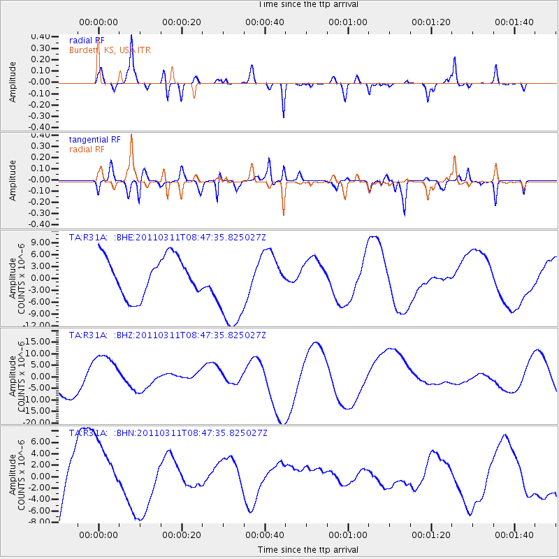
Signal To Noise
| Channel | StoN | STA | LTA |
| TA:R31A: :BHZ:20110311T08:47:35.825027Z | 2.4064605 | 9.706647E-6 | 4.033578E-6 |
| TA:R31A: :BHN:20110311T08:47:35.825027Z | 1.1839166 | 6.2947843E-6 | 5.3169156E-6 |
| TA:R31A: :BHE:20110311T08:47:35.825027Z | 2.2953308 | 1.1134755E-5 | 4.851046E-6 |
| Arrivals |
| Ps | |
| PpPs | |
| PsPs/PpSs | |


