LVA2 AZ.LVA2 - Earthquake Result Viewer
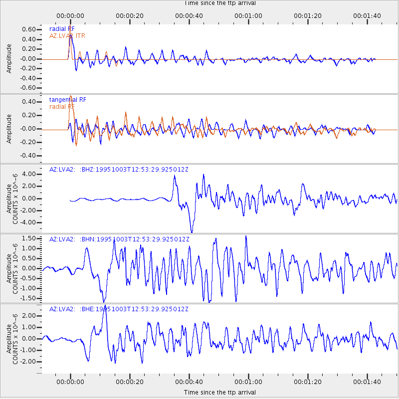
Earthquake location: Peru-Ecuador Border Region
Earthquake latitude/longitude: -2.8/-77.9
Earthquake time(UTC): 1995/10/03 (276) 12:45:00 GMT
Earthquake Depth: 33 km
Earthquake Magnitude: 6.0 MB, 6.1 MS, 5.9 UNKNOWN, 6.4 MW
Earthquake Catalog/Contributor: WHDF/NEIC
Network: AZ ANZA Regional Network
Station: LVA2 AZ.LVA2
Lat/Lon: 33.35 N/116.56 W
Elevation: 1435 m
Distance: 51.2 deg
Az: 317.886 deg
Baz: 126.846 deg
Ray Param: 0.06747843
Estimated Moho Depth: 49.25 km
Estimated Crust Vp/Vs: 2.10
Assumed Crust Vp: 6.264 km/s
Estimated Crust Vs: 2.986 km/s
Estimated Crust Poisson's Ratio: 0.35
Radial Match: 90.68981 %
Radial Bump: 400
Transverse Match: 78.157135 %
Transverse Bump: 400
SOD ConfigId: 6273
Insert Time: 2010-02-26 19:47:53.211 +0000
GWidth: 2.5
Max Bumps: 400
Tol: 0.001

Signal To Noise

ChannelStoNSTALTA
AZ:LVA2: :BHN:19951003T12:53:29.925012Z1.02719821.8061822E-71.7583581E-7
AZ:LVA2: :BHE:19951003T12:53:29.925012Z1.08915982.4031448E-72.2064206E-7
AZ:LVA2: :BHZ:19951003T12:53:29.925012Z4.22662266.155335E-71.4563248E-7
Arrivals
Ps9.0 SECOND
PpPs23 SECOND
PsPs/PpSs32 SECOND