You are here: Home > Network List > TA - USArray Transportable Network (new EarthScope stations) Stations List
> Station Q30A Quinter, KS, USA > Earthquake Result Viewer
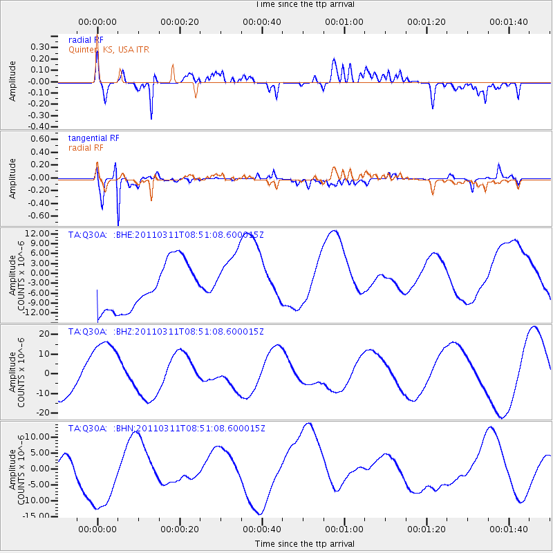
Q30A Quinter, KS, USA - Earthquake Result Viewer
*The percent match for this event was below the threshold and hence no stack was calculated.
| Earthquake location: |
Off East Coast Of Honshu, Japan |
| Earthquake latitude/longitude: |
37.6/142.8 |
| Earthquake time(UTC): |
2011/03/11 (070) 08:39:12 GMT |
| Earthquake Depth: |
46 km |
| Earthquake Magnitude: |
5.5 MB |
| Earthquake Catalog/Contributor: |
WHDF/NEIC |
|
| Network: |
TA USArray Transportable Network (new EarthScope stations) |
| Station: |
Q30A Quinter, KS, USA |
| Lat/Lon: |
38.98 N/100.22 W |
| Elevation: |
797 m |
|
| Distance: |
84.3 deg |
| Az: |
44.262 deg |
| Baz: |
314.698 deg |
| Ray Param: |
$rayparam |
*The percent match for this event was below the threshold and hence was not used in the summary stack. |
|
| Radial Match: |
55.77404 % |
| Radial Bump: |
400 |
| Transverse Match: |
77.37442 % |
| Transverse Bump: |
400 |
| SOD ConfigId: |
356183 |
| Insert Time: |
2011-08-13 19:43:31.311 +0000 |
| GWidth: |
2.5 |
| Max Bumps: |
400 |
| Tol: |
0.001 |
|
Signal To Noise
| Channel | StoN | STA | LTA |
| TA:Q30A: :BHZ:20110311T08:51:08.600015Z | 2.6959445 | 1.731357E-5 | 6.4220794E-6 |
| TA:Q30A: :BHN:20110311T08:51:08.600015Z | 3.2114553 | 1.1000217E-5 | 3.4253057E-6 |
| TA:Q30A: :BHE:20110311T08:51:08.600015Z | 1.265456 | 8.915993E-6 | 7.0456763E-6 |
| Arrivals |
| Ps | |
| PpPs | |
| PsPs/PpSs | |


