You are here: Home > Network List > TA - USArray Transportable Network (new EarthScope stations) Stations List
> Station D37A Cotton, MN, USA > Earthquake Result Viewer
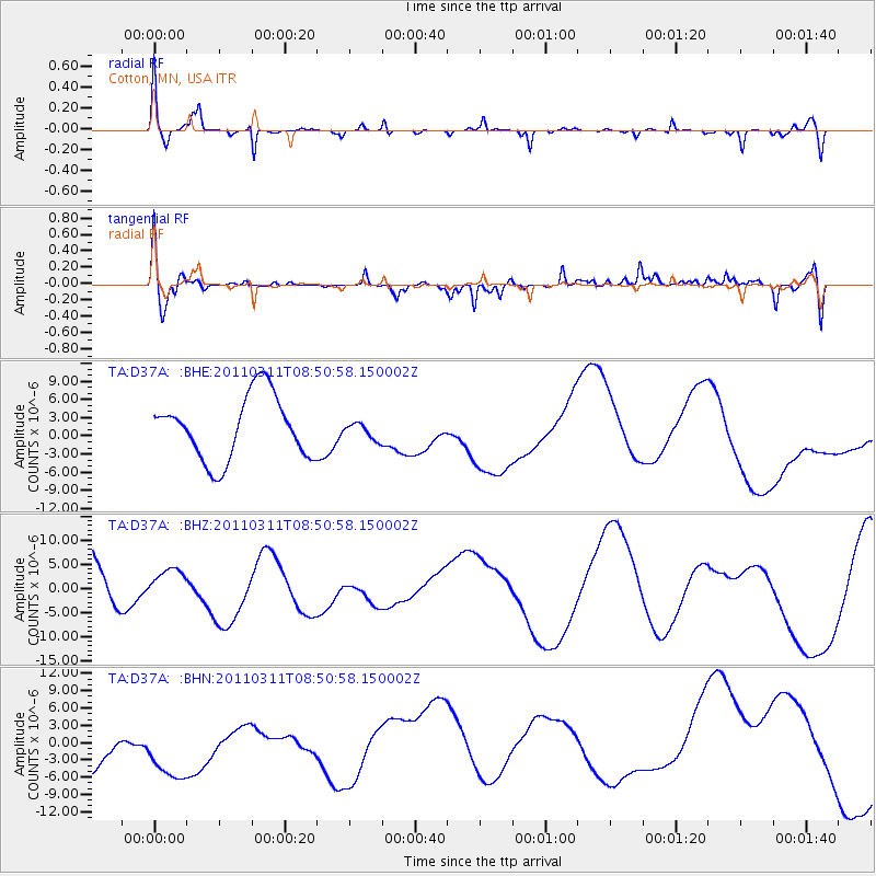
D37A Cotton, MN, USA - Earthquake Result Viewer
*The percent match for this event was below the threshold and hence no stack was calculated.
| Earthquake location: |
Off East Coast Of Honshu, Japan |
| Earthquake latitude/longitude: |
37.6/142.8 |
| Earthquake time(UTC): |
2011/03/11 (070) 08:39:12 GMT |
| Earthquake Depth: |
46 km |
| Earthquake Magnitude: |
5.5 MB |
| Earthquake Catalog/Contributor: |
WHDF/NEIC |
|
| Network: |
TA USArray Transportable Network (new EarthScope stations) |
| Station: |
D37A Cotton, MN, USA |
| Lat/Lon: |
47.16 N/92.43 W |
| Elevation: |
413 m |
|
| Distance: |
82.2 deg |
| Az: |
34.441 deg |
| Baz: |
318.861 deg |
| Ray Param: |
$rayparam |
*The percent match for this event was below the threshold and hence was not used in the summary stack. |
|
| Radial Match: |
48.74273 % |
| Radial Bump: |
258 |
| Transverse Match: |
50.586185 % |
| Transverse Bump: |
400 |
| SOD ConfigId: |
356183 |
| Insert Time: |
2011-08-13 20:10:13.060 +0000 |
| GWidth: |
2.5 |
| Max Bumps: |
400 |
| Tol: |
0.001 |
|
Signal To Noise
| Channel | StoN | STA | LTA |
| TA:D37A: :BHZ:20110311T08:50:58.150002Z | 0.56780225 | 4.49203E-6 | 7.911258E-6 |
| TA:D37A: :BHN:20110311T08:50:58.150002Z | 1.1621426 | 9.514493E-6 | 8.187027E-6 |
| TA:D37A: :BHE:20110311T08:50:58.150002Z | 0.25871766 | 1.3413711E-6 | 5.184691E-6 |
| Arrivals |
| Ps | |
| PpPs | |
| PsPs/PpSs | |


