You are here: Home > Network List > TA - USArray Transportable Network (new EarthScope stations) Stations List
> Station F35A Swanville, MN, USA > Earthquake Result Viewer
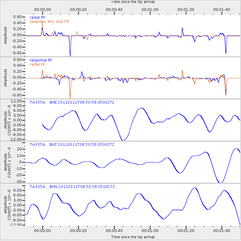
F35A Swanville, MN, USA - Earthquake Result Viewer
*The percent match for this event was below the threshold and hence no stack was calculated.
| Earthquake location: |
Off East Coast Of Honshu, Japan |
| Earthquake latitude/longitude: |
37.6/142.8 |
| Earthquake time(UTC): |
2011/03/11 (070) 08:39:12 GMT |
| Earthquake Depth: |
46 km |
| Earthquake Magnitude: |
5.5 MB |
| Earthquake Catalog/Contributor: |
WHDF/NEIC |
|
| Network: |
TA USArray Transportable Network (new EarthScope stations) |
| Station: |
F35A Swanville, MN, USA |
| Lat/Lon: |
45.86 N/94.57 W |
| Elevation: |
376 m |
|
| Distance: |
82.2 deg |
| Az: |
36.432 deg |
| Baz: |
317.578 deg |
| Ray Param: |
$rayparam |
*The percent match for this event was below the threshold and hence was not used in the summary stack. |
|
| Radial Match: |
68.42546 % |
| Radial Bump: |
234 |
| Transverse Match: |
46.68828 % |
| Transverse Bump: |
400 |
| SOD ConfigId: |
356183 |
| Insert Time: |
2011-08-13 20:10:41.368 +0000 |
| GWidth: |
2.5 |
| Max Bumps: |
400 |
| Tol: |
0.001 |
|
Signal To Noise
| Channel | StoN | STA | LTA |
| TA:F35A: :BHZ:20110311T08:50:58.050027Z | 0.7980709 | 6.920718E-6 | 8.671808E-6 |
| TA:F35A: :BHN:20110311T08:50:58.050027Z | 1.2502567 | 7.368284E-6 | 5.893417E-6 |
| TA:F35A: :BHE:20110311T08:50:58.050027Z | 0.56305176 | 2.4226763E-6 | 4.3027594E-6 |
| Arrivals |
| Ps | |
| PpPs | |
| PsPs/PpSs | |


