You are here: Home > Network List > TA - USArray Transportable Network (new EarthScope stations) Stations List
> Station N38A Joe's South Fork Station, Corydon, IA, USA > Earthquake Result Viewer
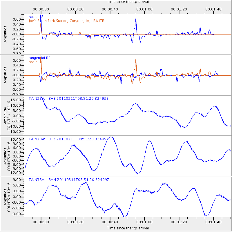
N38A Joe's South Fork Station, Corydon, IA, USA - Earthquake Result Viewer
*The percent match for this event was below the threshold and hence no stack was calculated.
| Earthquake location: |
Off East Coast Of Honshu, Japan |
| Earthquake latitude/longitude: |
37.6/142.8 |
| Earthquake time(UTC): |
2011/03/11 (070) 08:39:12 GMT |
| Earthquake Depth: |
46 km |
| Earthquake Magnitude: |
5.5 MB |
| Earthquake Catalog/Contributor: |
WHDF/NEIC |
|
| Network: |
TA USArray Transportable Network (new EarthScope stations) |
| Station: |
N38A Joe's South Fork Station, Corydon, IA, USA |
| Lat/Lon: |
40.79 N/93.24 W |
| Elevation: |
317 m |
|
| Distance: |
86.6 deg |
| Az: |
39.092 deg |
| Baz: |
318.753 deg |
| Ray Param: |
$rayparam |
*The percent match for this event was below the threshold and hence was not used in the summary stack. |
|
| Radial Match: |
59.77738 % |
| Radial Bump: |
400 |
| Transverse Match: |
65.174 % |
| Transverse Bump: |
305 |
| SOD ConfigId: |
356183 |
| Insert Time: |
2011-08-13 20:17:28.283 +0000 |
| GWidth: |
2.5 |
| Max Bumps: |
400 |
| Tol: |
0.001 |
|
Signal To Noise
| Channel | StoN | STA | LTA |
| TA:N38A: :BHZ:20110311T08:51:20.32499Z | 0.36780787 | 3.9548872E-6 | 1.0752589E-5 |
| TA:N38A: :BHN:20110311T08:51:20.32499Z | 1.0584477 | 4.6453056E-6 | 4.3887903E-6 |
| TA:N38A: :BHE:20110311T08:51:20.32499Z | 1.7274904 | 1.0135695E-5 | 5.8672945E-6 |
| Arrivals |
| Ps | |
| PpPs | |
| PsPs/PpSs | |


