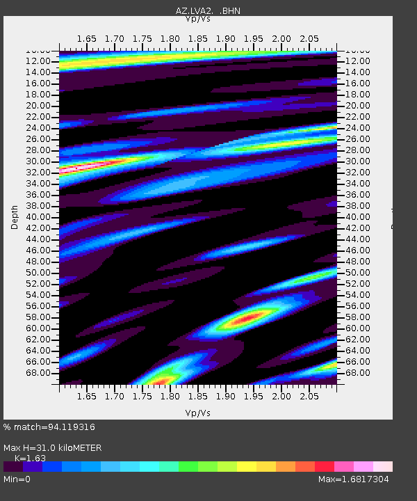
LVA2 AZ.LVA2 - Earthquake Result Viewer
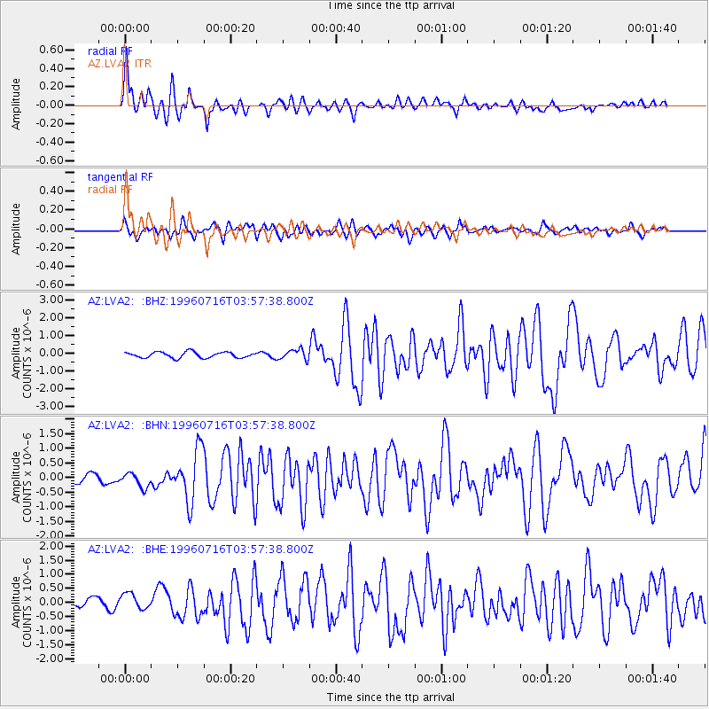
Earthquake location: Komandorskiye Ostrova Region
Earthquake latitude/longitude: 56.1/165.0
Earthquake time(UTC): 1996/07/16 (198) 03:48:28 GMT
Earthquake Depth: 33 km
Earthquake Magnitude: 5.8 MB, 6.4 MS, 6.5 UNKNOWN, 6.3 MW
Earthquake Catalog/Contributor: WHDF/NEIC
Network: AZ ANZA Regional Network
Station: LVA2 AZ.LVA2
Lat/Lon: 33.35 N/116.56 W
Elevation: 1435 m
Distance: 56.8 deg
Az: 78.432 deg
Baz: 318.995 deg
Ray Param: 0.063827775
Estimated Moho Depth: 31.0 km
Estimated Crust Vp/Vs: 1.63
Assumed Crust Vp: 6.264 km/s
Estimated Crust Vs: 3.843 km/s
Estimated Crust Poisson's Ratio: 0.20
Radial Match: 94.119316 %
Radial Bump: 400
Transverse Match: 74.822754 %
Transverse Bump: 400
SOD ConfigId: 6273
Insert Time: 2010-02-26 19:48:26.984 +0000
GWidth: 2.5
Max Bumps: 400
Tol: 0.001

Signal To Noise

ChannelStoNSTALTA
AZ:LVA2: :BHN:19960716T03:57:38.800Z2.1348972.720779E-71.2744309E-7
AZ:LVA2: :BHE:19960716T03:57:38.800Z1.30599583.3276993E-72.5480168E-7
AZ:LVA2: :BHZ:19960716T03:57:38.800Z1.83539162.9024142E-71.5813596E-7
Arrivals
Ps3.3 SECOND
PpPs12 SECOND
PsPs/PpSs16 SECOND