LVA2 AZ.LVA2 - Earthquake Result Viewer
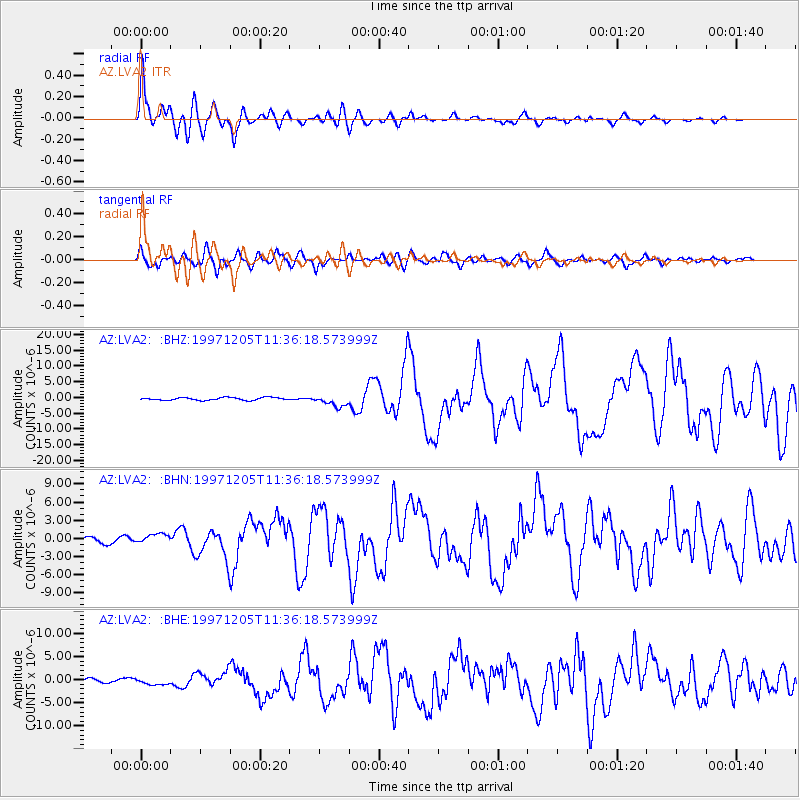
Earthquake location: Near East Coast Of Kamchatka
Earthquake latitude/longitude: 54.8/162.0
Earthquake time(UTC): 1997/12/05 (339) 11:26:54 GMT
Earthquake Depth: 33 km
Earthquake Magnitude: 6.3 MB, 7.6 MS, 7.9 UNKNOWN, 7.3 ME
Earthquake Catalog/Contributor: WHDF/NEIC
Network: AZ ANZA Regional Network
Station: LVA2 AZ.LVA2
Lat/Lon: 33.35 N/116.56 W
Elevation: 1435 m
Distance: 58.8 deg
Az: 75.472 deg
Baz: 318.012 deg
Ray Param: 0.062582195
Estimated Moho Depth: 29.25 km
Estimated Crust Vp/Vs: 1.73
Assumed Crust Vp: 6.264 km/s
Estimated Crust Vs: 3.615 km/s
Estimated Crust Poisson's Ratio: 0.25
Radial Match: 95.67029 %
Radial Bump: 400
Transverse Match: 83.51829 %
Transverse Bump: 400
SOD ConfigId: 9875
Insert Time: 2010-02-26 19:48:36.613 +0000
GWidth: 2.5
Max Bumps: 400
Tol: 0.001

Signal To Noise

ChannelStoNSTALTA
AZ:LVA2: :BHN:19971205T11:36:18.573999Z1.89333987.801124E-74.120298E-7
AZ:LVA2: :BHE:19971205T11:36:18.573999Z1.31811967.0526926E-75.3505704E-7
AZ:LVA2: :BHZ:19971205T11:36:18.573999Z4.2192791.7950385E-64.2543732E-7
Arrivals
Ps3.6 SECOND
PpPs12 SECOND
PsPs/PpSs16 SECOND