LVA2 AZ.LVA2 - Earthquake Result Viewer
Earthquake location: Near Coast Of Central Chile
Earthquake latitude/longitude: -30.9/-71.2
Earthquake time(UTC): 1997/10/15 (288) 01:03:33 GMT
Earthquake Depth: 58 km
Earthquake Magnitude: 6.8 MB, 6.8 MS, 7.3 UNKNOWN, 7.1 MW
Earthquake Catalog/Contributor: WHDF/NEIC
Network: AZ ANZA Regional Network
Station: LVA2 AZ.LVA2
Lat/Lon: 33.35 N/116.56 W
Elevation: 1435 m
Distance: 77.0 deg
Az: 322.329 deg
Baz: 141.142 deg
Ray Param: 0.050531667
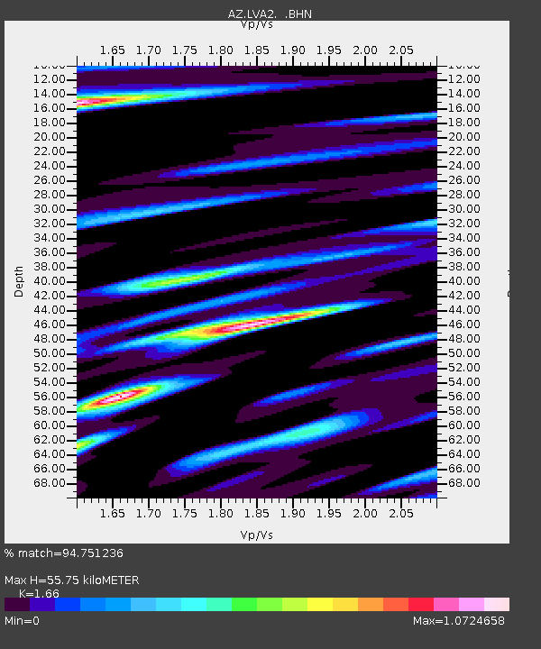
Estimated Moho Depth: 55.75 km
Estimated Crust Vp/Vs: 1.66
Assumed Crust Vp: 6.264 km/s
Estimated Crust Vs: 3.773 km/s
Estimated Crust Poisson's Ratio: 0.22
Radial Match: 94.751236 %
Radial Bump: 400
Transverse Match: 87.40336 %
Transverse Bump: 400
SOD ConfigId: 9875
Insert Time: 2010-02-26 19:48:46.008 +0000
GWidth: 2.5
Max Bumps: 400
Tol: 0.001

Signal To Noise

ChannelStoNSTALTA
AZ:LVA2: :BHN:19971015T01:14:48.800024Z0.957141342.0064223E-72.0962655E-7
AZ:LVA2: :BHE:19971015T01:14:48.800024Z0.81399331.709705E-72.1003919E-7
AZ:LVA2: :BHZ:19971015T01:14:48.800024Z2.04338554.2692986E-72.089326E-7
Arrivals
Ps6.1 SECOND
PpPs23 SECOND
PsPs/PpSs29 SECOND