You are here: Home > Network List > TA - USArray Transportable Network (new EarthScope stations) Stations List
> Station 334A Lometa, TX, USA > Earthquake Result Viewer
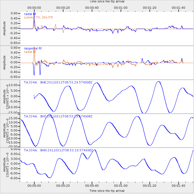
334A Lometa, TX, USA - Earthquake Result Viewer
*The percent match for this event was below the threshold and hence no stack was calculated.
| Earthquake location: |
Eastern Honshu, Japan |
| Earthquake latitude/longitude: |
37.4/141.0 |
| Earthquake time(UTC): |
2011/03/11 (070) 08:40:56 GMT |
| Earthquake Depth: |
40 km |
| Earthquake Magnitude: |
5.9 MB |
| Earthquake Catalog/Contributor: |
WHDF/NEIC |
|
| Network: |
TA USArray Transportable Network (new EarthScope stations) |
| Station: |
334A Lometa, TX, USA |
| Lat/Lon: |
31.33 N/98.24 W |
| Elevation: |
389 m |
|
| Distance: |
92.0 deg |
| Az: |
47.362 deg |
| Baz: |
316.826 deg |
| Ray Param: |
$rayparam |
*The percent match for this event was below the threshold and hence was not used in the summary stack. |
|
| Radial Match: |
70.10286 % |
| Radial Bump: |
400 |
| Transverse Match: |
80.14944 % |
| Transverse Bump: |
379 |
| SOD ConfigId: |
356183 |
| Insert Time: |
2011-08-13 21:52:13.812 +0000 |
| GWidth: |
2.5 |
| Max Bumps: |
400 |
| Tol: |
0.001 |
|
Signal To Noise
| Channel | StoN | STA | LTA |
| TA:334A: :BHZ:20110311T08:53:29.574998Z | 1.6237563 | 1.6354008E-5 | 1.0071714E-5 |
| TA:334A: :BHN:20110311T08:53:29.574998Z | 4.1214066 | 7.873981E-6 | 1.9105082E-6 |
| TA:334A: :BHE:20110311T08:53:29.574998Z | 1.3707826 | 9.8158835E-6 | 7.160788E-6 |
| Arrivals |
| Ps | |
| PpPs | |
| PsPs/PpSs | |


