You are here: Home > Network List > TA - USArray Transportable Network (new EarthScope stations) Stations List
> Station F33A 5 Mile Ranch, Herman, MN, USA > Earthquake Result Viewer
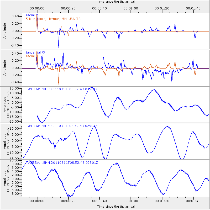
F33A 5 Mile Ranch, Herman, MN, USA - Earthquake Result Viewer
*The percent match for this event was below the threshold and hence no stack was calculated.
| Earthquake location: |
Eastern Honshu, Japan |
| Earthquake latitude/longitude: |
37.4/141.0 |
| Earthquake time(UTC): |
2011/03/11 (070) 08:40:56 GMT |
| Earthquake Depth: |
40 km |
| Earthquake Magnitude: |
5.9 MB |
| Earthquake Catalog/Contributor: |
WHDF/NEIC |
|
| Network: |
TA USArray Transportable Network (new EarthScope stations) |
| Station: |
F33A 5 Mile Ranch, Herman, MN, USA |
| Lat/Lon: |
45.84 N/96.29 W |
| Elevation: |
313 m |
|
| Distance: |
82.4 deg |
| Az: |
36.394 deg |
| Baz: |
317.507 deg |
| Ray Param: |
$rayparam |
*The percent match for this event was below the threshold and hence was not used in the summary stack. |
|
| Radial Match: |
61.76 % |
| Radial Bump: |
260 |
| Transverse Match: |
58.148937 % |
| Transverse Bump: |
400 |
| SOD ConfigId: |
356183 |
| Insert Time: |
2011-08-13 22:07:10.177 +0000 |
| GWidth: |
2.5 |
| Max Bumps: |
400 |
| Tol: |
0.001 |
|
Signal To Noise
| Channel | StoN | STA | LTA |
| TA:F33A: :BHZ:20110311T08:52:43.02501Z | 0.4895733 | 4.95891E-6 | 1.0129045E-5 |
| TA:F33A: :BHN:20110311T08:52:43.02501Z | 0.64854735 | 4.2923907E-6 | 6.618469E-6 |
| TA:F33A: :BHE:20110311T08:52:43.02501Z | 3.0175688 | 1.9035111E-5 | 6.308095E-6 |
| Arrivals |
| Ps | |
| PpPs | |
| PsPs/PpSs | |


