You are here: Home > Network List > G - GEOSCOPE Stations List
> Station INU Inuyama, Japan > Earthquake Result Viewer
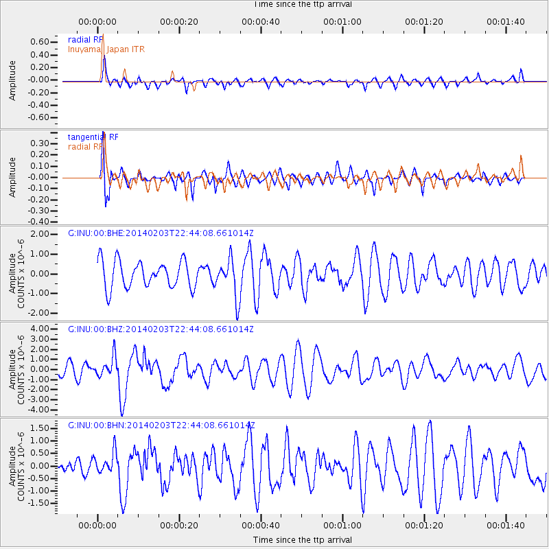
INU Inuyama, Japan - Earthquake Result Viewer
*The percent match for this event was below the threshold and hence no stack was calculated.
| Earthquake location: |
Banda Sea |
| Earthquake latitude/longitude: |
-7.2/128.2 |
| Earthquake time(UTC): |
2014/02/03 (034) 22:36:37 GMT |
| Earthquake Depth: |
7.1 km |
| Earthquake Magnitude: |
5.8 MWW, 5.8 MWB, 5.9 MWC |
| Earthquake Catalog/Contributor: |
NEIC PDE/NEIC COMCAT |
|
| Network: |
G GEOSCOPE |
| Station: |
INU Inuyama, Japan |
| Lat/Lon: |
35.35 N/137.03 E |
| Elevation: |
132 m |
|
| Distance: |
43.1 deg |
| Az: |
10.609 deg |
| Baz: |
192.913 deg |
| Ray Param: |
$rayparam |
*The percent match for this event was below the threshold and hence was not used in the summary stack. |
|
| Radial Match: |
49.820187 % |
| Radial Bump: |
400 |
| Transverse Match: |
52.569828 % |
| Transverse Bump: |
400 |
| SOD ConfigId: |
3390531 |
| Insert Time: |
2019-04-10 05:26:08.386 +0000 |
| GWidth: |
2.5 |
| Max Bumps: |
400 |
| Tol: |
0.001 |
|
Signal To Noise
| Channel | StoN | STA | LTA |
| G:INU:00:BHZ:20140203T22:44:08.661014Z | 1.187597 | 9.938465E-7 | 8.36855E-7 |
| G:INU:00:BHN:20140203T22:44:08.661014Z | 0.64513195 | 4.4198865E-7 | 6.8511355E-7 |
| G:INU:00:BHE:20140203T22:44:08.661014Z | 0.8054622 | 5.485669E-7 | 6.8105857E-7 |
| Arrivals |
| Ps | |
| PpPs | |
| PsPs/PpSs | |


