You are here: Home > Network List > TA - USArray Transportable Network (new EarthScope stations) Stations List
> Station Q30A Quinter, KS, USA > Earthquake Result Viewer
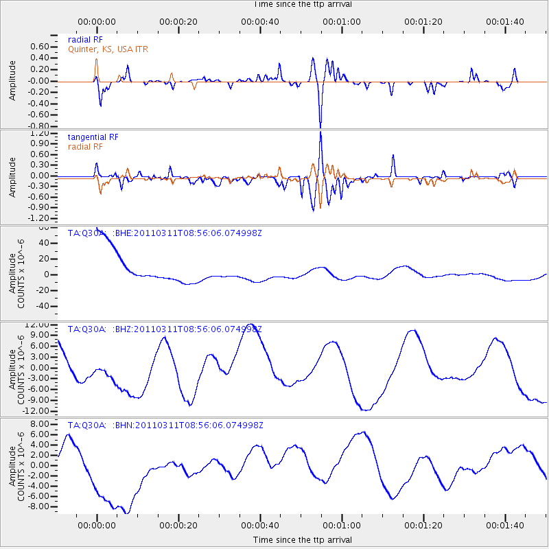
Q30A Quinter, KS, USA - Earthquake Result Viewer
*The percent match for this event was below the threshold and hence no stack was calculated.
| Earthquake location: |
Near East Coast Of Honshu, Japan |
| Earthquake latitude/longitude: |
36.1/141.0 |
| Earthquake time(UTC): |
2011/03/11 (070) 08:44:00 GMT |
| Earthquake Depth: |
47 km |
| Earthquake Magnitude: |
5.6 MB |
| Earthquake Catalog/Contributor: |
WHDF/NEIC |
|
| Network: |
TA USArray Transportable Network (new EarthScope stations) |
| Station: |
Q30A Quinter, KS, USA |
| Lat/Lon: |
38.98 N/100.22 W |
| Elevation: |
797 m |
|
| Distance: |
86.4 deg |
| Az: |
43.184 deg |
| Baz: |
314.697 deg |
| Ray Param: |
$rayparam |
*The percent match for this event was below the threshold and hence was not used in the summary stack. |
|
| Radial Match: |
64.710945 % |
| Radial Bump: |
400 |
| Transverse Match: |
47.071827 % |
| Transverse Bump: |
400 |
| SOD ConfigId: |
356183 |
| Insert Time: |
2011-08-13 23:26:03.357 +0000 |
| GWidth: |
2.5 |
| Max Bumps: |
400 |
| Tol: |
0.001 |
|
Signal To Noise
| Channel | StoN | STA | LTA |
| TA:Q30A: :BHZ:20110311T08:56:06.074998Z | 0.7491487 | 3.2601633E-6 | 4.351824E-6 |
| TA:Q30A: :BHN:20110311T08:56:06.074998Z | 1.2674136 | 1.38442265E-5 | 1.0923211E-5 |
| TA:Q30A: :BHE:20110311T08:56:06.074998Z | 0.46630153 | 9.874405E-6 | 2.1176009E-5 |
| Arrivals |
| Ps | |
| PpPs | |
| PsPs/PpSs | |


