You are here: Home > Network List > TA - USArray Transportable Network (new EarthScope stations) Stations List
> Station O30A M W Ranch, Wilsonville, NE, USA > Earthquake Result Viewer
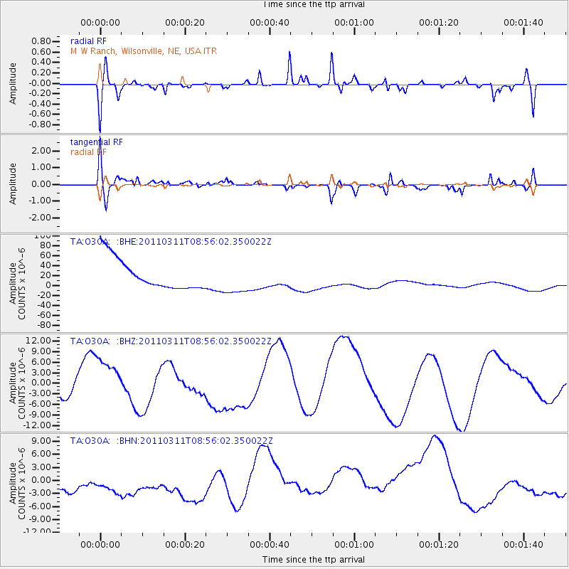
O30A M W Ranch, Wilsonville, NE, USA - Earthquake Result Viewer
*The percent match for this event was below the threshold and hence no stack was calculated.
| Earthquake location: |
Near East Coast Of Honshu, Japan |
| Earthquake latitude/longitude: |
36.1/141.0 |
| Earthquake time(UTC): |
2011/03/11 (070) 08:44:00 GMT |
| Earthquake Depth: |
47 km |
| Earthquake Magnitude: |
5.6 MB |
| Earthquake Catalog/Contributor: |
WHDF/NEIC |
|
| Network: |
TA USArray Transportable Network (new EarthScope stations) |
| Station: |
O30A M W Ranch, Wilsonville, NE, USA |
| Lat/Lon: |
40.18 N/100.06 W |
| Elevation: |
751 m |
|
| Distance: |
85.6 deg |
| Az: |
42.239 deg |
| Baz: |
314.734 deg |
| Ray Param: |
$rayparam |
*The percent match for this event was below the threshold and hence was not used in the summary stack. |
|
| Radial Match: |
41.957333 % |
| Radial Bump: |
400 |
| Transverse Match: |
41.42179 % |
| Transverse Bump: |
400 |
| SOD ConfigId: |
356183 |
| Insert Time: |
2011-08-13 23:28:04.394 +0000 |
| GWidth: |
2.5 |
| Max Bumps: |
400 |
| Tol: |
0.001 |
|
Signal To Noise
| Channel | StoN | STA | LTA |
| TA:O30A: :BHZ:20110311T08:56:02.350022Z | 1.3543336 | 6.858511E-6 | 5.064122E-6 |
| TA:O30A: :BHN:20110311T08:56:02.350022Z | 0.8541004 | 1.0676822E-5 | 1.2500664E-5 |
| TA:O30A: :BHE:20110311T08:56:02.350022Z | 1.0488955 | 3.1923588E-5 | 3.0435433E-5 |
| Arrivals |
| Ps | |
| PpPs | |
| PsPs/PpSs | |


