You are here: Home > Network List > TA - USArray Transportable Network (new EarthScope stations) Stations List
> Station O02D Mt. Diablo Meridian, CA, USA > Earthquake Result Viewer
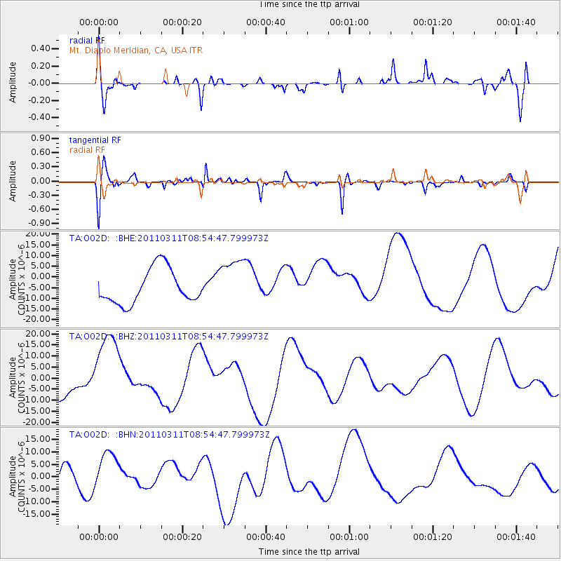
O02D Mt. Diablo Meridian, CA, USA - Earthquake Result Viewer
*The percent match for this event was below the threshold and hence no stack was calculated.
| Earthquake location: |
Near East Coast Of Honshu, Japan |
| Earthquake latitude/longitude: |
36.1/141.0 |
| Earthquake time(UTC): |
2011/03/11 (070) 08:44:00 GMT |
| Earthquake Depth: |
47 km |
| Earthquake Magnitude: |
5.6 MB |
| Earthquake Catalog/Contributor: |
WHDF/NEIC |
|
| Network: |
TA USArray Transportable Network (new EarthScope stations) |
| Station: |
O02D Mt. Diablo Meridian, CA, USA |
| Lat/Lon: |
40.18 N/122.79 W |
| Elevation: |
965 m |
|
| Distance: |
72.0 deg |
| Az: |
53.228 deg |
| Baz: |
302.173 deg |
| Ray Param: |
$rayparam |
*The percent match for this event was below the threshold and hence was not used in the summary stack. |
|
| Radial Match: |
46.113083 % |
| Radial Bump: |
392 |
| Transverse Match: |
64.04007 % |
| Transverse Bump: |
315 |
| SOD ConfigId: |
356183 |
| Insert Time: |
2011-08-13 23:48:15.783 +0000 |
| GWidth: |
2.5 |
| Max Bumps: |
400 |
| Tol: |
0.001 |
|
Signal To Noise
| Channel | StoN | STA | LTA |
| TA:O02D: :BHZ:20110311T08:54:47.799973Z | 5.209694 | 1.9398094E-5 | 3.7234613E-6 |
| TA:O02D: :BHN:20110311T08:54:47.799973Z | 1.1452085 | 9.232023E-6 | 8.0614345E-6 |
| TA:O02D: :BHE:20110311T08:54:47.799973Z | 1.4621178 | 1.1699882E-5 | 8.00201E-6 |
| Arrivals |
| Ps | |
| PpPs | |
| PsPs/PpSs | |


