You are here: Home > Network List > US - United States National Seismic Network Stations List
> Station NEW Newport, Washington, USA > Earthquake Result Viewer
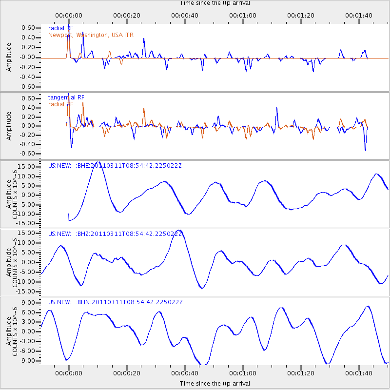
NEW Newport, Washington, USA - Earthquake Result Viewer
*The percent match for this event was below the threshold and hence no stack was calculated.
| Earthquake location: |
Near East Coast Of Honshu, Japan |
| Earthquake latitude/longitude: |
36.1/141.0 |
| Earthquake time(UTC): |
2011/03/11 (070) 08:44:00 GMT |
| Earthquake Depth: |
47 km |
| Earthquake Magnitude: |
5.6 MB |
| Earthquake Catalog/Contributor: |
WHDF/NEIC |
|
| Network: |
US United States National Seismic Network |
| Station: |
NEW Newport, Washington, USA |
| Lat/Lon: |
48.26 N/117.12 W |
| Elevation: |
760 m |
|
| Distance: |
71.0 deg |
| Az: |
43.735 deg |
| Baz: |
303.105 deg |
| Ray Param: |
$rayparam |
*The percent match for this event was below the threshold and hence was not used in the summary stack. |
|
| Radial Match: |
61.291393 % |
| Radial Bump: |
232 |
| Transverse Match: |
55.50833 % |
| Transverse Bump: |
400 |
| SOD ConfigId: |
356183 |
| Insert Time: |
2011-08-14 00:00:31.488 +0000 |
| GWidth: |
2.5 |
| Max Bumps: |
400 |
| Tol: |
0.001 |
|
Signal To Noise
| Channel | StoN | STA | LTA |
| US:NEW: :BHZ:20110311T08:54:42.225022Z | 0.98010343 | 7.859155E-6 | 8.018699E-6 |
| US:NEW: :BHN:20110311T08:54:42.225022Z | 0.74149626 | 4.661902E-6 | 6.2871554E-6 |
| US:NEW: :BHE:20110311T08:54:42.225022Z | 0.72197855 | 6.6978764E-6 | 9.277113E-6 |
| Arrivals |
| Ps | |
| PpPs | |
| PsPs/PpSs | |


