You are here: Home > Network List > TA - USArray Transportable Network (new EarthScope stations) Stations List
> Station 434A Burnet, TX, USA > Earthquake Result Viewer
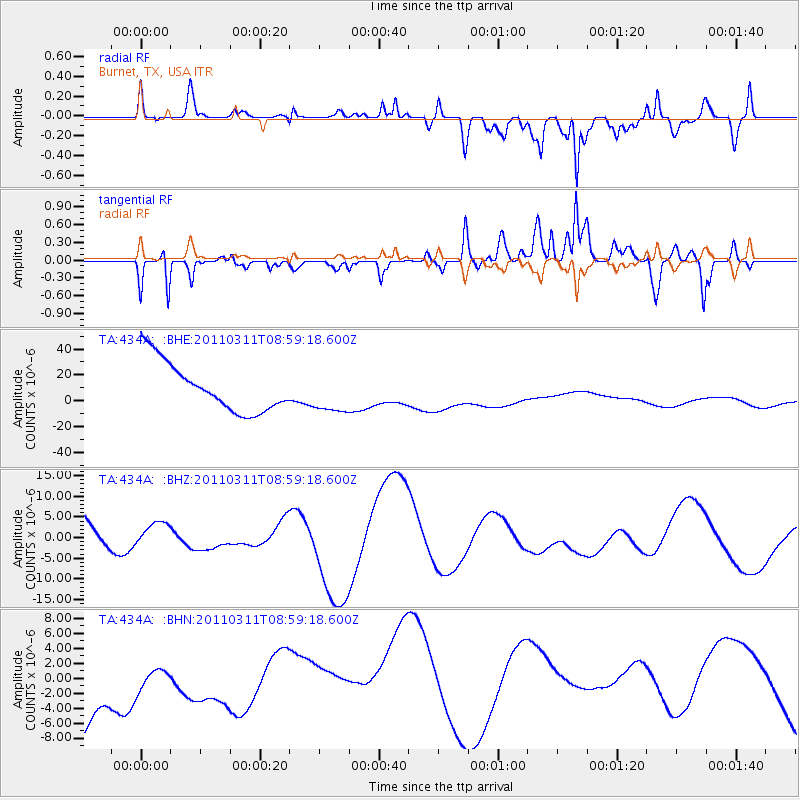
434A Burnet, TX, USA - Earthquake Result Viewer
*The percent match for this event was below the threshold and hence no stack was calculated.
| Earthquake location: |
Off East Coast Of Honshu, Japan |
| Earthquake latitude/longitude: |
37.4/142.5 |
| Earthquake time(UTC): |
2011/03/11 (070) 08:46:45 GMT |
| Earthquake Depth: |
26 km |
| Earthquake Magnitude: |
5.6 MB |
| Earthquake Catalog/Contributor: |
WHDF/NEIC |
|
| Network: |
TA USArray Transportable Network (new EarthScope stations) |
| Station: |
434A Burnet, TX, USA |
| Lat/Lon: |
30.81 N/98.27 W |
| Elevation: |
462 m |
|
| Distance: |
91.5 deg |
| Az: |
48.65 deg |
| Baz: |
315.994 deg |
| Ray Param: |
$rayparam |
*The percent match for this event was below the threshold and hence was not used in the summary stack. |
|
| Radial Match: |
63.919888 % |
| Radial Bump: |
400 |
| Transverse Match: |
49.79603 % |
| Transverse Bump: |
400 |
| SOD ConfigId: |
356183 |
| Insert Time: |
2011-08-14 00:59:49.135 +0000 |
| GWidth: |
2.5 |
| Max Bumps: |
400 |
| Tol: |
0.001 |
|
Signal To Noise
| Channel | StoN | STA | LTA |
| TA:434A: :BHZ:20110311T08:59:18.600Z | 0.57015836 | 2.651675E-6 | 4.6507694E-6 |
| TA:434A: :BHN:20110311T08:59:18.600Z | 0.35404828 | 3.6695596E-6 | 1.0364573E-5 |
| TA:434A: :BHE:20110311T08:59:18.600Z | 0.8436115 | 1.6080676E-5 | 1.9061708E-5 |
| Arrivals |
| Ps | |
| PpPs | |
| PsPs/PpSs | |


