You are here: Home > Network List > TA - USArray Transportable Network (new EarthScope stations) Stations List
> Station K34A Le Mars, IA, USA > Earthquake Result Viewer
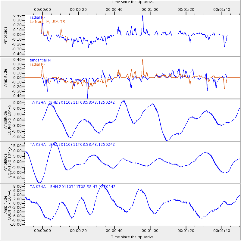
K34A Le Mars, IA, USA - Earthquake Result Viewer
*The percent match for this event was below the threshold and hence no stack was calculated.
| Earthquake location: |
Off East Coast Of Honshu, Japan |
| Earthquake latitude/longitude: |
37.4/142.5 |
| Earthquake time(UTC): |
2011/03/11 (070) 08:46:45 GMT |
| Earthquake Depth: |
26 km |
| Earthquake Magnitude: |
5.6 MB |
| Earthquake Catalog/Contributor: |
WHDF/NEIC |
|
| Network: |
TA USArray Transportable Network (new EarthScope stations) |
| Station: |
K34A Le Mars, IA, USA |
| Lat/Lon: |
42.69 N/96.10 W |
| Elevation: |
436 m |
|
| Distance: |
84.1 deg |
| Az: |
39.222 deg |
| Baz: |
316.937 deg |
| Ray Param: |
$rayparam |
*The percent match for this event was below the threshold and hence was not used in the summary stack. |
|
| Radial Match: |
76.05589 % |
| Radial Bump: |
400 |
| Transverse Match: |
55.63616 % |
| Transverse Bump: |
359 |
| SOD ConfigId: |
356183 |
| Insert Time: |
2011-08-14 01:11:55.658 +0000 |
| GWidth: |
2.5 |
| Max Bumps: |
400 |
| Tol: |
0.001 |
|
Signal To Noise
| Channel | StoN | STA | LTA |
| TA:K34A: :BHZ:20110311T08:58:43.125024Z | 1.7579598 | 1.1717656E-5 | 6.6654857E-6 |
| TA:K34A: :BHN:20110311T08:58:43.125024Z | 4.1374125 | 1.00188845E-5 | 2.421534E-6 |
| TA:K34A: :BHE:20110311T08:58:43.125024Z | 1.0056293 | 5.211813E-6 | 5.1826382E-6 |
| Arrivals |
| Ps | |
| PpPs | |
| PsPs/PpSs | |


