You are here: Home > Network List > TA - USArray Transportable Network (new EarthScope stations) Stations List
> Station A33A Warroad, MN, USA > Earthquake Result Viewer
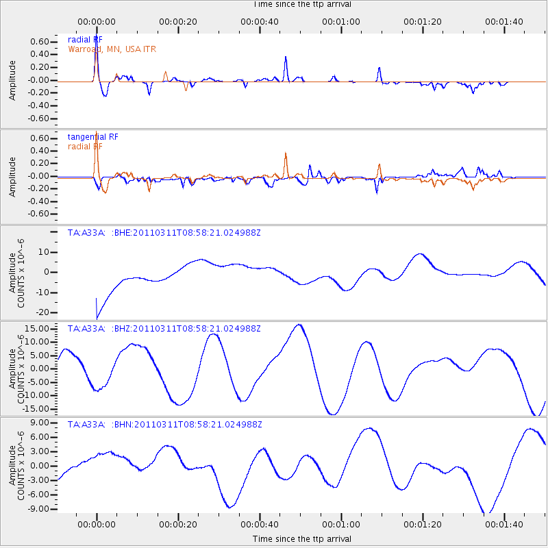
A33A Warroad, MN, USA - Earthquake Result Viewer
*The percent match for this event was below the threshold and hence no stack was calculated.
| Earthquake location: |
Off East Coast Of Honshu, Japan |
| Earthquake latitude/longitude: |
37.4/142.5 |
| Earthquake time(UTC): |
2011/03/11 (070) 08:46:45 GMT |
| Earthquake Depth: |
26 km |
| Earthquake Magnitude: |
5.6 MB |
| Earthquake Catalog/Contributor: |
WHDF/NEIC |
|
| Network: |
TA USArray Transportable Network (new EarthScope stations) |
| Station: |
A33A Warroad, MN, USA |
| Lat/Lon: |
48.94 N/95.39 W |
| Elevation: |
329 m |
|
| Distance: |
79.9 deg |
| Az: |
34.543 deg |
| Baz: |
316.791 deg |
| Ray Param: |
$rayparam |
*The percent match for this event was below the threshold and hence was not used in the summary stack. |
|
| Radial Match: |
73.85615 % |
| Radial Bump: |
400 |
| Transverse Match: |
36.899315 % |
| Transverse Bump: |
400 |
| SOD ConfigId: |
356183 |
| Insert Time: |
2011-08-14 01:15:33.400 +0000 |
| GWidth: |
2.5 |
| Max Bumps: |
400 |
| Tol: |
0.001 |
|
Signal To Noise
| Channel | StoN | STA | LTA |
| TA:A33A: :BHZ:20110311T08:58:21.024988Z | 0.8454632 | 5.6632057E-6 | 6.6983466E-6 |
| TA:A33A: :BHN:20110311T08:58:21.024988Z | 1.1878878 | 4.351697E-6 | 3.6633908E-6 |
| TA:A33A: :BHE:20110311T08:58:21.024988Z | 1.213034 | 7.655042E-6 | 6.3106577E-6 |
| Arrivals |
| Ps | |
| PpPs | |
| PsPs/PpSs | |


