You are here: Home > Network List > TA - USArray Transportable Network (new EarthScope stations) Stations List
> Station J31A Geddes, SD, USA > Earthquake Result Viewer
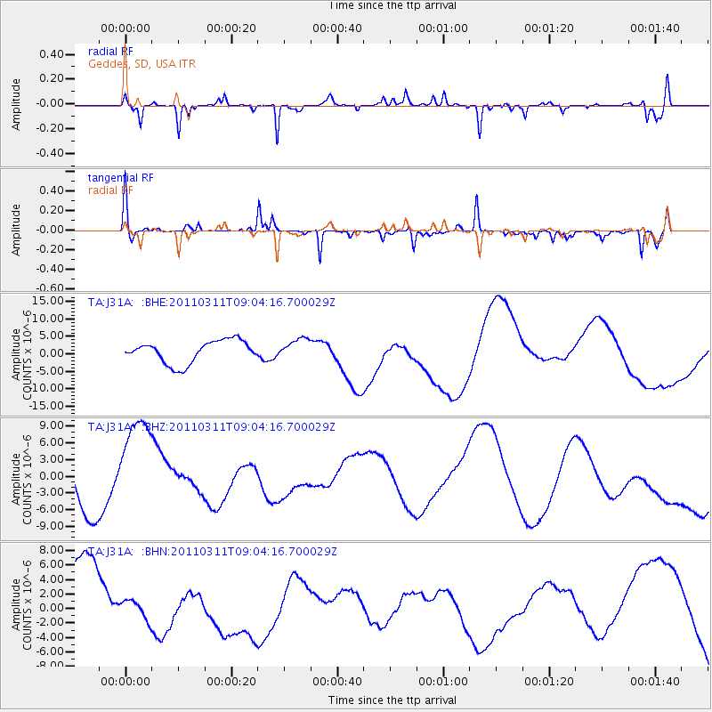
J31A Geddes, SD, USA - Earthquake Result Viewer
*The percent match for this event was below the threshold and hence no stack was calculated.
| Earthquake location: |
Near East Coast Of Honshu, Japan |
| Earthquake latitude/longitude: |
36.8/141.9 |
| Earthquake time(UTC): |
2011/03/11 (070) 08:52:23 GMT |
| Earthquake Depth: |
17 km |
| Earthquake Magnitude: |
5.5 MB |
| Earthquake Catalog/Contributor: |
WHDF/NEIC |
|
| Network: |
TA USArray Transportable Network (new EarthScope stations) |
| Station: |
J31A Geddes, SD, USA |
| Lat/Lon: |
43.29 N/98.74 W |
| Elevation: |
491 m |
|
| Distance: |
83.1 deg |
| Az: |
39.879 deg |
| Baz: |
315.163 deg |
| Ray Param: |
$rayparam |
*The percent match for this event was below the threshold and hence was not used in the summary stack. |
|
| Radial Match: |
66.56885 % |
| Radial Bump: |
220 |
| Transverse Match: |
63.88808 % |
| Transverse Bump: |
223 |
| SOD ConfigId: |
356183 |
| Insert Time: |
2011-08-14 02:47:04.080 +0000 |
| GWidth: |
2.5 |
| Max Bumps: |
400 |
| Tol: |
0.001 |
|
Signal To Noise
| Channel | StoN | STA | LTA |
| TA:J31A: :BHZ:20110311T09:04:16.700029Z | 1.5501277 | 1.0648371E-5 | 6.869351E-6 |
| TA:J31A: :BHN:20110311T09:04:16.700029Z | 0.28240624 | 1.396008E-6 | 4.943262E-6 |
| TA:J31A: :BHE:20110311T09:04:16.700029Z | 0.8825209 | 2.818457E-6 | 3.1936434E-6 |
| Arrivals |
| Ps | |
| PpPs | |
| PsPs/PpSs | |


