You are here: Home > Network List > TA - USArray Transportable Network (new EarthScope stations) Stations List
> Station D35A Remer, MN, USA > Earthquake Result Viewer
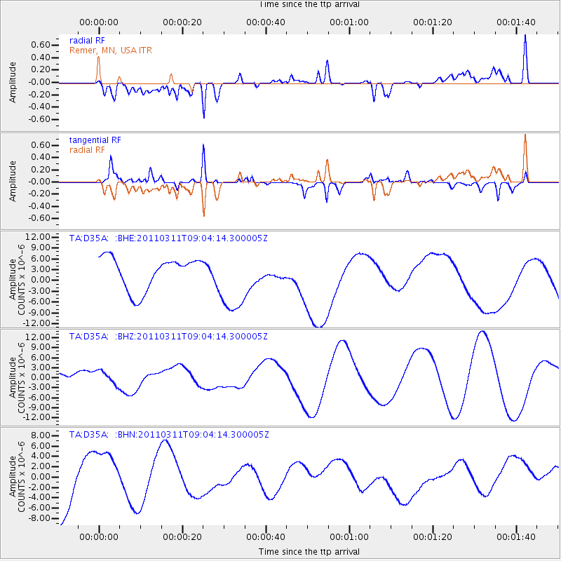
D35A Remer, MN, USA - Earthquake Result Viewer
*The percent match for this event was below the threshold and hence no stack was calculated.
| Earthquake location: |
Near East Coast Of Honshu, Japan |
| Earthquake latitude/longitude: |
36.8/141.9 |
| Earthquake time(UTC): |
2011/03/11 (070) 08:52:23 GMT |
| Earthquake Depth: |
17 km |
| Earthquake Magnitude: |
5.5 MB |
| Earthquake Catalog/Contributor: |
WHDF/NEIC |
|
| Network: |
TA USArray Transportable Network (new EarthScope stations) |
| Station: |
D35A Remer, MN, USA |
| Lat/Lon: |
47.08 N/94.05 W |
| Elevation: |
427 m |
|
| Distance: |
82.6 deg |
| Az: |
34.829 deg |
| Baz: |
317.853 deg |
| Ray Param: |
$rayparam |
*The percent match for this event was below the threshold and hence was not used in the summary stack. |
|
| Radial Match: |
54.90537 % |
| Radial Bump: |
400 |
| Transverse Match: |
58.644432 % |
| Transverse Bump: |
253 |
| SOD ConfigId: |
356183 |
| Insert Time: |
2011-08-14 02:50:33.978 +0000 |
| GWidth: |
2.5 |
| Max Bumps: |
400 |
| Tol: |
0.001 |
|
Signal To Noise
| Channel | StoN | STA | LTA |
| TA:D35A: :BHZ:20110311T09:04:14.300005Z | 0.8360327 | 2.181089E-6 | 2.6088562E-6 |
| TA:D35A: :BHN:20110311T09:04:14.300005Z | 0.9889559 | 6.3991656E-6 | 6.470628E-6 |
| TA:D35A: :BHE:20110311T09:04:14.300005Z | 2.124788 | 9.463229E-6 | 4.4537283E-6 |
| Arrivals |
| Ps | |
| PpPs | |
| PsPs/PpSs | |


