You are here: Home > Network List > TA - USArray Transportable Network (new EarthScope stations) Stations List
> Station C38A Sawbill Landing (USFS), Superior Nat. Forest, MN, > Earthquake Result Viewer
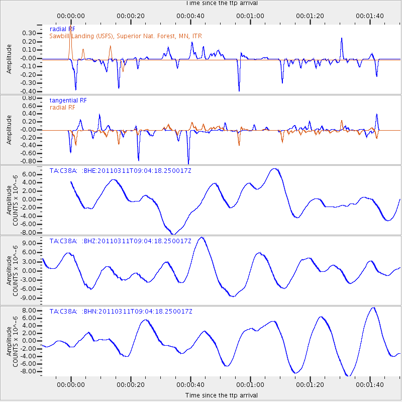
C38A Sawbill Landing (USFS), Superior Nat. Forest, MN, - Earthquake Result Viewer
*The percent match for this event was below the threshold and hence no stack was calculated.
| Earthquake location: |
Near East Coast Of Honshu, Japan |
| Earthquake latitude/longitude: |
36.8/141.9 |
| Earthquake time(UTC): |
2011/03/11 (070) 08:52:23 GMT |
| Earthquake Depth: |
17 km |
| Earthquake Magnitude: |
5.5 MB |
| Earthquake Catalog/Contributor: |
WHDF/NEIC |
|
| Network: |
TA USArray Transportable Network (new EarthScope stations) |
| Station: |
C38A Sawbill Landing (USFS), Superior Nat. Forest, MN, |
| Lat/Lon: |
47.72 N/91.27 W |
| Elevation: |
498 m |
|
| Distance: |
83.4 deg |
| Az: |
32.976 deg |
| Baz: |
319.668 deg |
| Ray Param: |
$rayparam |
*The percent match for this event was below the threshold and hence was not used in the summary stack. |
|
| Radial Match: |
58.885242 % |
| Radial Bump: |
230 |
| Transverse Match: |
89.900154 % |
| Transverse Bump: |
260 |
| SOD ConfigId: |
356183 |
| Insert Time: |
2011-08-14 02:53:13.490 +0000 |
| GWidth: |
2.5 |
| Max Bumps: |
400 |
| Tol: |
0.001 |
|
Signal To Noise
| Channel | StoN | STA | LTA |
| TA:C38A: :BHZ:20110311T09:04:18.250017Z | 1.1664107 | 4.4187373E-6 | 3.78832E-6 |
| TA:C38A: :BHN:20110311T09:04:18.250017Z | 1.0873947 | 1.1689672E-6 | 1.0750165E-6 |
| TA:C38A: :BHE:20110311T09:04:18.250017Z | 3.4089158 | 7.329312E-6 | 2.150042E-6 |
| Arrivals |
| Ps | |
| PpPs | |
| PsPs/PpSs | |


