You are here: Home > Network List > TA - USArray Transportable Network (new EarthScope stations) Stations List
> Station O37A Wolven Farm, McFall, MO, USA > Earthquake Result Viewer
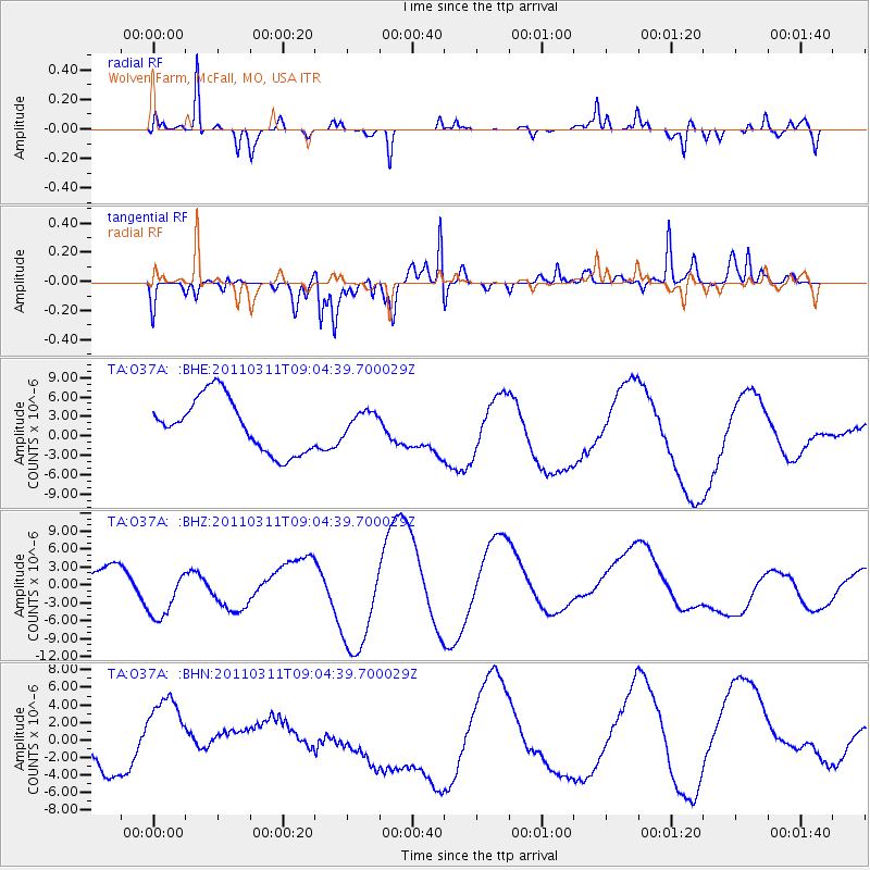
O37A Wolven Farm, McFall, MO, USA - Earthquake Result Viewer
*The percent match for this event was below the threshold and hence no stack was calculated.
| Earthquake location: |
Near East Coast Of Honshu, Japan |
| Earthquake latitude/longitude: |
36.8/141.9 |
| Earthquake time(UTC): |
2011/03/11 (070) 08:52:23 GMT |
| Earthquake Depth: |
17 km |
| Earthquake Magnitude: |
5.5 MB |
| Earthquake Catalog/Contributor: |
WHDF/NEIC |
|
| Network: |
TA USArray Transportable Network (new EarthScope stations) |
| Station: |
O37A Wolven Farm, McFall, MO, USA |
| Lat/Lon: |
40.17 N/94.15 W |
| Elevation: |
284 m |
|
| Distance: |
87.7 deg |
| Az: |
39.518 deg |
| Baz: |
318.183 deg |
| Ray Param: |
$rayparam |
*The percent match for this event was below the threshold and hence was not used in the summary stack. |
|
| Radial Match: |
60.011204 % |
| Radial Bump: |
289 |
| Transverse Match: |
63.539677 % |
| Transverse Bump: |
383 |
| SOD ConfigId: |
356183 |
| Insert Time: |
2011-08-14 02:56:21.391 +0000 |
| GWidth: |
2.5 |
| Max Bumps: |
400 |
| Tol: |
0.001 |
|
Signal To Noise
| Channel | StoN | STA | LTA |
| TA:O37A: :BHZ:20110311T09:04:39.700029Z | 1.5759528 | 5.551543E-6 | 3.5226583E-6 |
| TA:O37A: :BHN:20110311T09:04:39.700029Z | 1.6236509 | 4.053359E-6 | 2.4964475E-6 |
| TA:O37A: :BHE:20110311T09:04:39.700029Z | 0.43718722 | 1.8147284E-6 | 4.150918E-6 |
| Arrivals |
| Ps | |
| PpPs | |
| PsPs/PpSs | |


