You are here: Home > Network List > TA - USArray Transportable Network (new EarthScope stations) Stations List
> Station S38A Stockton, MO, USA > Earthquake Result Viewer
S38A Stockton, MO, USA - Earthquake Result Viewer
*The percent match for this event was below the threshold and hence no stack was calculated.
| Earthquake location: |
Near East Coast Of Honshu, Japan |
| Earthquake latitude/longitude: |
36.8/141.9 |
| Earthquake time(UTC): |
2011/03/11 (070) 08:52:23 GMT |
| Earthquake Depth: |
17 km |
| Earthquake Magnitude: |
5.5 MB |
| Earthquake Catalog/Contributor: |
WHDF/NEIC |
|
| Network: |
TA USArray Transportable Network (new EarthScope stations) |
| Station: |
S38A Stockton, MO, USA |
| Lat/Lon: |
37.63 N/93.91 W |
| Elevation: |
294 m |
|
| Distance: |
89.8 deg |
| Az: |
41.065 deg |
| Baz: |
318.366 deg |
| Ray Param: |
$rayparam |
*The percent match for this event was below the threshold and hence was not used in the summary stack. |
|
| Radial Match: |
42.143642 % |
| Radial Bump: |
246 |
| Transverse Match: |
41.626564 % |
| Transverse Bump: |
332 |
| SOD ConfigId: |
356183 |
| Insert Time: |
2011-08-14 02:57:02.406 +0000 |
| GWidth: |
2.5 |
| Max Bumps: |
400 |
| Tol: |
0.001 |
|
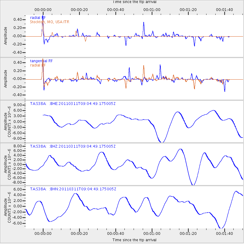
Signal To Noise
| Channel | StoN | STA | LTA |
| TA:S38A: :BHZ:20110311T09:04:49.175005Z | 0.6543722 | 3.010676E-6 | 4.6008613E-6 |
| TA:S38A: :BHN:20110311T09:04:49.175005Z | 1.6584874 | 4.9100527E-6 | 2.9605606E-6 |
| TA:S38A: :BHE:20110311T09:04:49.175005Z | 0.9736189 | 1.9176805E-6 | 1.969642E-6 |
| Arrivals |
| Ps | |
| PpPs | |
| PsPs/PpSs | |


