You are here: Home > Network List > TA - USArray Transportable Network (new EarthScope stations) Stations List
> Station T30A Plains, KS, USA > Earthquake Result Viewer
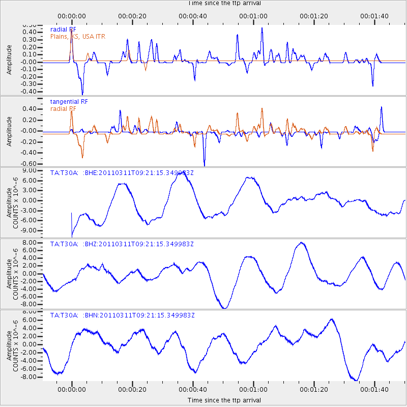
T30A Plains, KS, USA - Earthquake Result Viewer
*The percent match for this event was below the threshold and hence no stack was calculated.
| Earthquake location: |
Off East Coast Of Honshu, Japan |
| Earthquake latitude/longitude: |
37.7/143.3 |
| Earthquake time(UTC): |
2011/03/11 (070) 09:09:14 GMT |
| Earthquake Depth: |
39 km |
| Earthquake Magnitude: |
5.5 MB |
| Earthquake Catalog/Contributor: |
WHDF/NEIC |
|
| Network: |
TA USArray Transportable Network (new EarthScope stations) |
| Station: |
T30A Plains, KS, USA |
| Lat/Lon: |
37.05 N/100.53 W |
| Elevation: |
778 m |
|
| Distance: |
85.1 deg |
| Az: |
46.112 deg |
| Baz: |
314.38 deg |
| Ray Param: |
$rayparam |
*The percent match for this event was below the threshold and hence was not used in the summary stack. |
|
| Radial Match: |
53.15239 % |
| Radial Bump: |
390 |
| Transverse Match: |
33.754875 % |
| Transverse Bump: |
186 |
| SOD ConfigId: |
356183 |
| Insert Time: |
2011-08-14 03:54:24.985 +0000 |
| GWidth: |
2.5 |
| Max Bumps: |
400 |
| Tol: |
0.001 |
|
Signal To Noise
| Channel | StoN | STA | LTA |
| TA:T30A: :BHZ:20110311T09:21:15.349983Z | 0.74552417 | 1.7584791E-6 | 2.3587152E-6 |
| TA:T30A: :BHN:20110311T09:21:15.349983Z | 0.7832065 | 2.5390818E-6 | 3.2419057E-6 |
| TA:T30A: :BHE:20110311T09:21:15.349983Z | 1.3004117 | 5.7544157E-6 | 4.4250723E-6 |
| Arrivals |
| Ps | |
| PpPs | |
| PsPs/PpSs | |


