You are here: Home > Network List > AZ - ANZA Regional Network Stations List
> Station LVA2 AZ.LVA2 > Earthquake Result Viewer
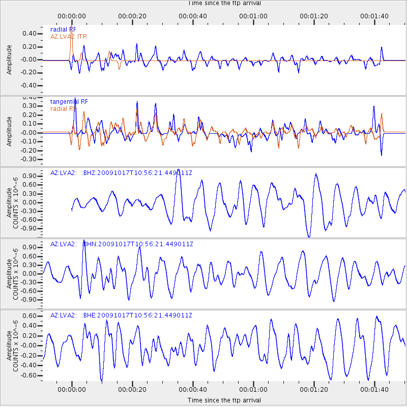
LVA2 AZ.LVA2 - Earthquake Result Viewer
*The percent match for this event was below the threshold and hence no stack was calculated.
| Earthquake location: |
Samoa Islands Region |
| Earthquake latitude/longitude: |
-16.4/-172.0 |
| Earthquake time(UTC): |
2009/10/17 (290) 10:45:26 GMT |
| Earthquake Depth: |
10 km |
| Earthquake Magnitude: |
5.7 MB, 5.3 MS, 5.7 MW, 5.7 MW |
| Earthquake Catalog/Contributor: |
WHDF/NEIC |
|
| Network: |
AZ ANZA Regional Network |
| Station: |
LVA2 AZ.LVA2 |
| Lat/Lon: |
33.35 N/116.56 W |
| Elevation: |
1435 m |
|
| Distance: |
72.4 deg |
| Az: |
46.312 deg |
| Baz: |
236.034 deg |
| Ray Param: |
$rayparam |
*The percent match for this event was below the threshold and hence was not used in the summary stack. |
|
| Radial Match: |
43.02977 % |
| Radial Bump: |
400 |
| Transverse Match: |
60.435028 % |
| Transverse Bump: |
400 |
| SOD ConfigId: |
2622 |
| Insert Time: |
2010-02-26 19:51:12.504 +0000 |
| GWidth: |
2.5 |
| Max Bumps: |
400 |
| Tol: |
0.001 |
|
Signal To Noise
| Channel | StoN | STA | LTA |
| AZ:LVA2: :BHN:20091017T10:56:21.449011Z | 1.7693298 | 5.036456E-7 | 2.846533E-7 |
| AZ:LVA2: :BHE:20091017T10:56:21.449011Z | 0.76012874 | 2.376737E-7 | 3.1267558E-7 |
| AZ:LVA2: :BHZ:20091017T10:56:21.449011Z | 2.6853654 | 4.784073E-7 | 1.7815351E-7 |
| Arrivals |
| Ps | |
| PpPs | |
| PsPs/PpSs | |


