You are here: Home > Network List > TA - USArray Transportable Network (new EarthScope stations) Stations List
> Station Z36A Blue Ridge, TX, USA > Earthquake Result Viewer
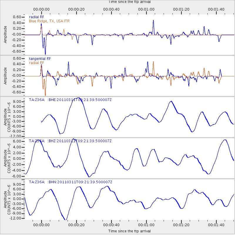
Z36A Blue Ridge, TX, USA - Earthquake Result Viewer
*The percent match for this event was below the threshold and hence no stack was calculated.
| Earthquake location: |
Off East Coast Of Honshu, Japan |
| Earthquake latitude/longitude: |
37.7/143.3 |
| Earthquake time(UTC): |
2011/03/11 (070) 09:09:14 GMT |
| Earthquake Depth: |
39 km |
| Earthquake Magnitude: |
5.5 MB |
| Earthquake Catalog/Contributor: |
WHDF/NEIC |
|
| Network: |
TA USArray Transportable Network (new EarthScope stations) |
| Station: |
Z36A Blue Ridge, TX, USA |
| Lat/Lon: |
33.27 N/96.43 W |
| Elevation: |
187 m |
|
| Distance: |
90.1 deg |
| Az: |
46.358 deg |
| Baz: |
316.739 deg |
| Ray Param: |
$rayparam |
*The percent match for this event was below the threshold and hence was not used in the summary stack. |
|
| Radial Match: |
73.94708 % |
| Radial Bump: |
361 |
| Transverse Match: |
58.42562 % |
| Transverse Bump: |
242 |
| SOD ConfigId: |
356183 |
| Insert Time: |
2011-08-14 04:16:27.154 +0000 |
| GWidth: |
2.5 |
| Max Bumps: |
400 |
| Tol: |
0.001 |
|
Signal To Noise
| Channel | StoN | STA | LTA |
| TA:Z36A: :BHZ:20110311T09:21:39.500007Z | 1.4963726 | 6.11883E-6 | 4.089108E-6 |
| TA:Z36A: :BHN:20110311T09:21:39.500007Z | 0.7154522 | 3.3543158E-6 | 4.6883856E-6 |
| TA:Z36A: :BHE:20110311T09:21:39.500007Z | 0.81056136 | 5.673091E-6 | 6.998965E-6 |
| Arrivals |
| Ps | |
| PpPs | |
| PsPs/PpSs | |


