You are here: Home > Network List > TA - USArray Transportable Network (new EarthScope stations) Stations List
> Station V38A Canehill, AR, USA > Earthquake Result Viewer
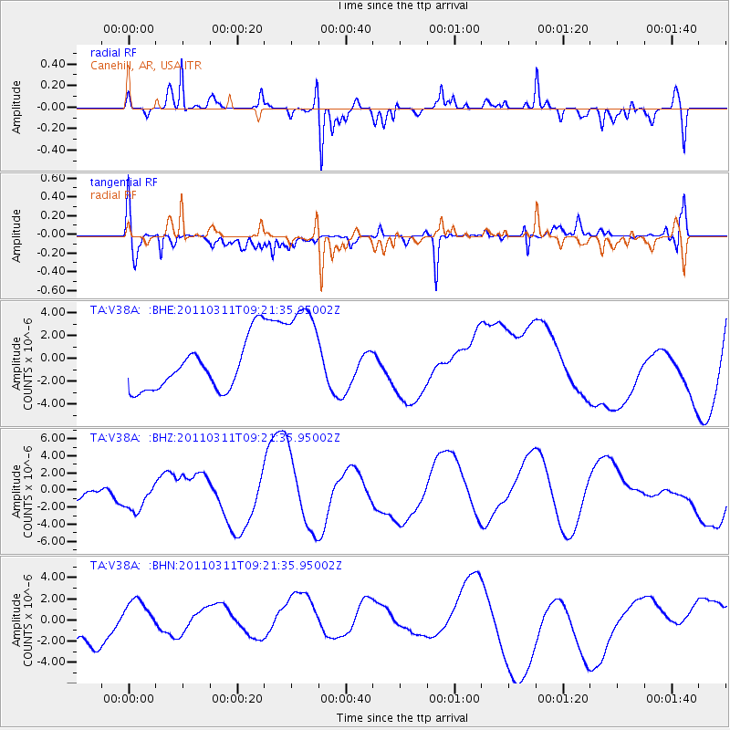
V38A Canehill, AR, USA - Earthquake Result Viewer
*The percent match for this event was below the threshold and hence no stack was calculated.
| Earthquake location: |
Off East Coast Of Honshu, Japan |
| Earthquake latitude/longitude: |
37.7/143.3 |
| Earthquake time(UTC): |
2011/03/11 (070) 09:09:14 GMT |
| Earthquake Depth: |
39 km |
| Earthquake Magnitude: |
5.5 MB |
| Earthquake Catalog/Contributor: |
WHDF/NEIC |
|
| Network: |
TA USArray Transportable Network (new EarthScope stations) |
| Station: |
V38A Canehill, AR, USA |
| Lat/Lon: |
35.86 N/94.41 W |
| Elevation: |
372 m |
|
| Distance: |
89.4 deg |
| Az: |
43.376 deg |
| Baz: |
317.871 deg |
| Ray Param: |
$rayparam |
*The percent match for this event was below the threshold and hence was not used in the summary stack. |
|
| Radial Match: |
65.66739 % |
| Radial Bump: |
381 |
| Transverse Match: |
60.801846 % |
| Transverse Bump: |
400 |
| SOD ConfigId: |
356183 |
| Insert Time: |
2011-08-14 04:17:38.574 +0000 |
| GWidth: |
2.5 |
| Max Bumps: |
400 |
| Tol: |
0.001 |
|
Signal To Noise
| Channel | StoN | STA | LTA |
| TA:V38A: :BHZ:20110311T09:21:35.95002Z | 2.479147 | 2.1851838E-6 | 8.814257E-7 |
| TA:V38A: :BHN:20110311T09:21:35.95002Z | 0.7186919 | 1.6975308E-6 | 2.361973E-6 |
| TA:V38A: :BHE:20110311T09:21:35.95002Z | 2.2607617 | 4.6737473E-6 | 2.067333E-6 |
| Arrivals |
| Ps | |
| PpPs | |
| PsPs/PpSs | |


