You are here: Home > Network List > TA - USArray Transportable Network (new EarthScope stations) Stations List
> Station G32A Webster, SD, USA > Earthquake Result Viewer
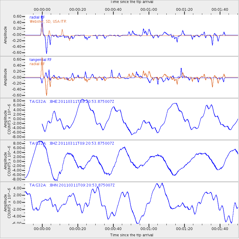
G32A Webster, SD, USA - Earthquake Result Viewer
*The percent match for this event was below the threshold and hence no stack was calculated.
| Earthquake location: |
Off East Coast Of Honshu, Japan |
| Earthquake latitude/longitude: |
37.7/143.3 |
| Earthquake time(UTC): |
2011/03/11 (070) 09:09:14 GMT |
| Earthquake Depth: |
39 km |
| Earthquake Magnitude: |
5.5 MB |
| Earthquake Catalog/Contributor: |
WHDF/NEIC |
|
| Network: |
TA USArray Transportable Network (new EarthScope stations) |
| Station: |
G32A Webster, SD, USA |
| Lat/Lon: |
45.26 N/97.50 W |
| Elevation: |
566 m |
|
| Distance: |
80.9 deg |
| Az: |
38.641 deg |
| Baz: |
315.461 deg |
| Ray Param: |
$rayparam |
*The percent match for this event was below the threshold and hence was not used in the summary stack. |
|
| Radial Match: |
77.33875 % |
| Radial Bump: |
400 |
| Transverse Match: |
57.8409 % |
| Transverse Bump: |
339 |
| SOD ConfigId: |
356183 |
| Insert Time: |
2011-08-14 04:24:25.600 +0000 |
| GWidth: |
2.5 |
| Max Bumps: |
400 |
| Tol: |
0.001 |
|
Signal To Noise
| Channel | StoN | STA | LTA |
| TA:G32A: :BHZ:20110311T09:20:53.875007Z | 1.3696386 | 7.445731E-6 | 5.4362745E-6 |
| TA:G32A: :BHN:20110311T09:20:53.875007Z | 0.25492305 | 5.355336E-7 | 2.1007656E-6 |
| TA:G32A: :BHE:20110311T09:20:53.875007Z | 0.72572577 | 3.091287E-6 | 4.25958E-6 |
| Arrivals |
| Ps | |
| PpPs | |
| PsPs/PpSs | |


