You are here: Home > Network List > TA - USArray Transportable Network (new EarthScope stations) Stations List
> Station N34A Lincoln, NE, USA > Earthquake Result Viewer
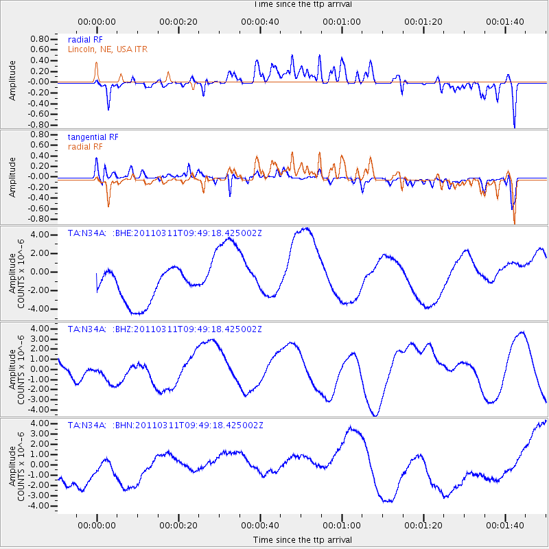
N34A Lincoln, NE, USA - Earthquake Result Viewer
*The percent match for this event was below the threshold and hence no stack was calculated.
| Earthquake location: |
Near East Coast Of Honshu, Japan |
| Earthquake latitude/longitude: |
35.9/141.6 |
| Earthquake time(UTC): |
2011/03/11 (070) 09:37:04 GMT |
| Earthquake Depth: |
5.8 km |
| Earthquake Magnitude: |
5.5 MB |
| Earthquake Catalog/Contributor: |
WHDF/NEIC |
|
| Network: |
TA USArray Transportable Network (new EarthScope stations) |
| Station: |
N34A Lincoln, NE, USA |
| Lat/Lon: |
40.84 N/96.50 W |
| Elevation: |
401 m |
|
| Distance: |
86.9 deg |
| Az: |
40.175 deg |
| Baz: |
316.351 deg |
| Ray Param: |
$rayparam |
*The percent match for this event was below the threshold and hence was not used in the summary stack. |
|
| Radial Match: |
52.16505 % |
| Radial Bump: |
400 |
| Transverse Match: |
62.87959 % |
| Transverse Bump: |
400 |
| SOD ConfigId: |
356183 |
| Insert Time: |
2011-08-14 06:01:25.561 +0000 |
| GWidth: |
2.5 |
| Max Bumps: |
400 |
| Tol: |
0.001 |
|
Signal To Noise
| Channel | StoN | STA | LTA |
| TA:N34A: :BHZ:20110311T09:49:18.425002Z | 1.1984135 | 1.1874807E-6 | 9.908773E-7 |
| TA:N34A: :BHN:20110311T09:49:18.425002Z | 0.6087502 | 1.746267E-6 | 2.86861E-6 |
| TA:N34A: :BHE:20110311T09:49:18.425002Z | 2.8096263 | 4.722055E-6 | 1.6806702E-6 |
| Arrivals |
| Ps | |
| PpPs | |
| PsPs/PpSs | |


