You are here: Home > Network List > TA - USArray Transportable Network (new EarthScope stations) Stations List
> Station F31A Hecla, SD, USA > Earthquake Result Viewer
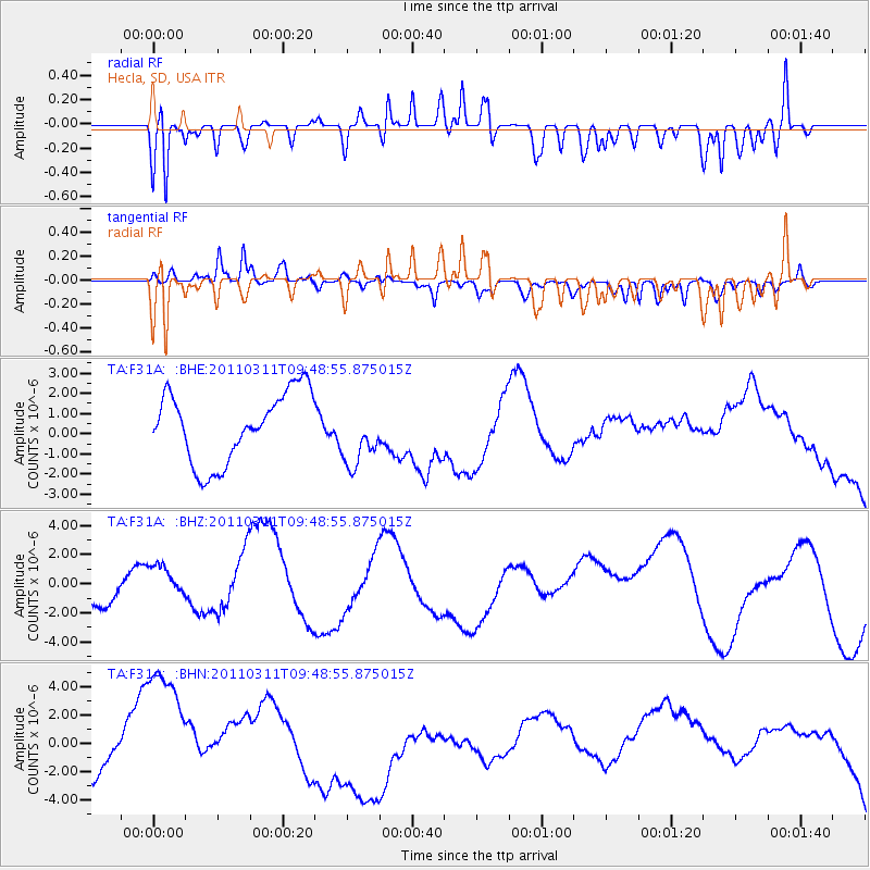
F31A Hecla, SD, USA - Earthquake Result Viewer
*The percent match for this event was below the threshold and hence no stack was calculated.
| Earthquake location: |
Near East Coast Of Honshu, Japan |
| Earthquake latitude/longitude: |
35.9/141.6 |
| Earthquake time(UTC): |
2011/03/11 (070) 09:37:04 GMT |
| Earthquake Depth: |
5.8 km |
| Earthquake Magnitude: |
5.5 MB |
| Earthquake Catalog/Contributor: |
WHDF/NEIC |
|
| Network: |
TA USArray Transportable Network (new EarthScope stations) |
| Station: |
F31A Hecla, SD, USA |
| Lat/Lon: |
45.86 N/98.25 W |
| Elevation: |
412 m |
|
| Distance: |
82.4 deg |
| Az: |
37.568 deg |
| Baz: |
314.907 deg |
| Ray Param: |
$rayparam |
*The percent match for this event was below the threshold and hence was not used in the summary stack. |
|
| Radial Match: |
64.20253 % |
| Radial Bump: |
400 |
| Transverse Match: |
43.893185 % |
| Transverse Bump: |
400 |
| SOD ConfigId: |
356183 |
| Insert Time: |
2011-08-14 06:08:12.686 +0000 |
| GWidth: |
2.5 |
| Max Bumps: |
400 |
| Tol: |
0.001 |
|
Signal To Noise
| Channel | StoN | STA | LTA |
| TA:F31A: :BHZ:20110311T09:48:55.875015Z | 0.7848628 | 1.1260573E-6 | 1.4347186E-6 |
| TA:F31A: :BHN:20110311T09:48:55.875015Z | 3.1169965 | 6.2496583E-6 | 2.0050256E-6 |
| TA:F31A: :BHE:20110311T09:48:55.875015Z | 0.88564444 | 1.5282311E-6 | 1.7255581E-6 |
| Arrivals |
| Ps | |
| PpPs | |
| PsPs/PpSs | |


