You are here: Home > Network List > US - United States National Seismic Network Stations List
> Station MIAR Mount Ida, Arkansas, USA > Earthquake Result Viewer
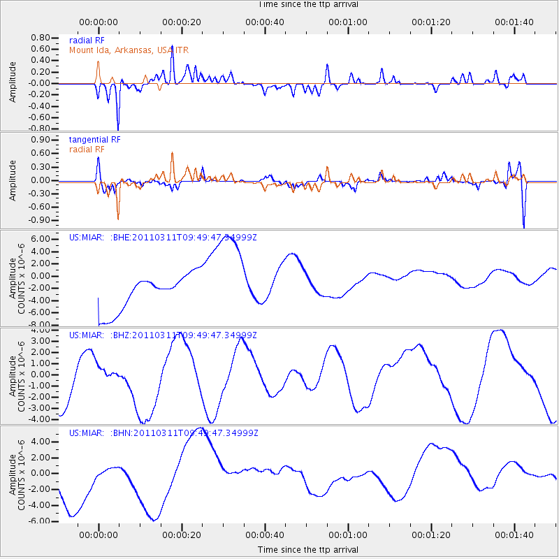
MIAR Mount Ida, Arkansas, USA - Earthquake Result Viewer
*The percent match for this event was below the threshold and hence no stack was calculated.
| Earthquake location: |
Near East Coast Of Honshu, Japan |
| Earthquake latitude/longitude: |
35.9/141.6 |
| Earthquake time(UTC): |
2011/03/11 (070) 09:37:04 GMT |
| Earthquake Depth: |
5.8 km |
| Earthquake Magnitude: |
5.5 MB |
| Earthquake Catalog/Contributor: |
WHDF/NEIC |
|
| Network: |
US United States National Seismic Network |
| Station: |
MIAR Mount Ida, Arkansas, USA |
| Lat/Lon: |
34.55 N/93.58 W |
| Elevation: |
207 m |
|
| Distance: |
93.0 deg |
| Az: |
42.733 deg |
| Baz: |
318.137 deg |
| Ray Param: |
$rayparam |
*The percent match for this event was below the threshold and hence was not used in the summary stack. |
|
| Radial Match: |
67.3916 % |
| Radial Bump: |
350 |
| Transverse Match: |
44.540012 % |
| Transverse Bump: |
400 |
| SOD ConfigId: |
356183 |
| Insert Time: |
2011-08-14 06:19:04.583 +0000 |
| GWidth: |
2.5 |
| Max Bumps: |
400 |
| Tol: |
0.001 |
|
Signal To Noise
| Channel | StoN | STA | LTA |
| US:MIAR: :BHZ:20110311T09:49:47.34999Z | 0.21696217 | 4.6317626E-7 | 2.1348249E-6 |
| US:MIAR: :BHN:20110311T09:49:47.34999Z | 0.22076318 | 6.135856E-7 | 2.779384E-6 |
| US:MIAR: :BHE:20110311T09:49:47.34999Z | 2.7776144 | 8.038761E-6 | 2.8941242E-6 |
| Arrivals |
| Ps | |
| PpPs | |
| PsPs/PpSs | |


