You are here: Home > Network List > TA - USArray Transportable Network (new EarthScope stations) Stations List
> Station D30A Buchanan, ND, USA > Earthquake Result Viewer
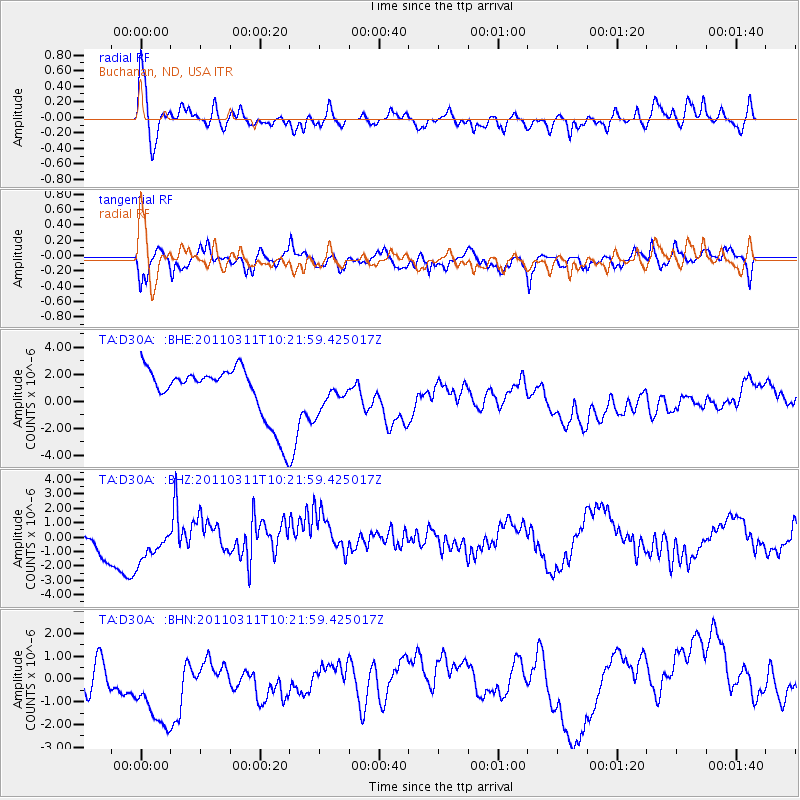
D30A Buchanan, ND, USA - Earthquake Result Viewer
*The percent match for this event was below the threshold and hence no stack was calculated.
| Earthquake location: |
Near East Coast Of Honshu, Japan |
| Earthquake latitude/longitude: |
39.2/142.8 |
| Earthquake time(UTC): |
2011/03/11 (070) 10:10:34 GMT |
| Earthquake Depth: |
26 km |
| Earthquake Magnitude: |
6.0 MB |
| Earthquake Catalog/Contributor: |
WHDF/NEIC |
|
| Network: |
TA USArray Transportable Network (new EarthScope stations) |
| Station: |
D30A Buchanan, ND, USA |
| Lat/Lon: |
47.11 N/98.76 W |
| Elevation: |
465 m |
|
| Distance: |
78.1 deg |
| Az: |
37.851 deg |
| Baz: |
315.721 deg |
| Ray Param: |
$rayparam |
*The percent match for this event was below the threshold and hence was not used in the summary stack. |
|
| Radial Match: |
52.964466 % |
| Radial Bump: |
400 |
| Transverse Match: |
53.24349 % |
| Transverse Bump: |
400 |
| SOD ConfigId: |
356183 |
| Insert Time: |
2011-08-14 07:29:24.319 +0000 |
| GWidth: |
2.5 |
| Max Bumps: |
400 |
| Tol: |
0.001 |
|
Signal To Noise
| Channel | StoN | STA | LTA |
| TA:D30A: :BHZ:20110311T10:21:59.425017Z | 1.321804 | 1.3767052E-6 | 1.041535E-6 |
| TA:D30A: :BHN:20110311T10:21:59.425017Z | 1.3839916 | 2.794935E-6 | 2.019474E-6 |
| TA:D30A: :BHE:20110311T10:21:59.425017Z | 0.5622407 | 1.0978298E-6 | 1.9525974E-6 |
| Arrivals |
| Ps | |
| PpPs | |
| PsPs/PpSs | |


