You are here: Home > Network List > AZ - ANZA Regional Network Stations List
> Station LVA2 AZ.LVA2 > Earthquake Result Viewer
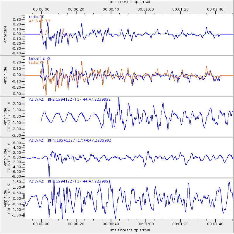
LVA2 AZ.LVA2 - Earthquake Result Viewer
*The percent match for this event was below the threshold and hence no stack was calculated.
| Earthquake location: |
South Of Kermadec Islands |
| Earthquake latitude/longitude: |
-32.0/179.9 |
| Earthquake time(UTC): |
1994/12/27 (361) 17:32:52 GMT |
| Earthquake Depth: |
228 km |
| Earthquake Magnitude: |
6.0 MB, 6.1 UNKNOWN, 6.4 MW |
| Earthquake Catalog/Contributor: |
WHDF/NEIC |
|
| Network: |
AZ ANZA Regional Network |
| Station: |
LVA2 AZ.LVA2 |
| Lat/Lon: |
33.35 N/116.56 W |
| Elevation: |
1435 m |
|
| Distance: |
88.4 deg |
| Az: |
48.571 deg |
| Baz: |
229.559 deg |
| Ray Param: |
$rayparam |
*The percent match for this event was below the threshold and hence was not used in the summary stack. |
|
| Radial Match: |
50.256413 % |
| Radial Bump: |
400 |
| Transverse Match: |
68.9382 % |
| Transverse Bump: |
400 |
| SOD ConfigId: |
4480 |
| Insert Time: |
2010-02-26 19:52:12.443 +0000 |
| GWidth: |
2.5 |
| Max Bumps: |
400 |
| Tol: |
0.001 |
|
Signal To Noise
| Channel | StoN | STA | LTA |
| AZ:LVA2: :BHN:19941227T17:44:47.223999Z | 11.622956 | 2.4220815E-6 | 2.0838773E-7 |
| AZ:LVA2: :BHE:19941227T17:44:47.223999Z | 1.8015958 | 6.07975E-7 | 3.3746468E-7 |
| AZ:LVA2: :BHZ:19941227T17:44:47.223999Z | 1.3908715 | 6.95554E-7 | 5.00085E-7 |
| Arrivals |
| Ps | |
| PpPs | |
| PsPs/PpSs | |


