You are here: Home > Network List > US - United States National Seismic Network Stations List
> Station HAWA Hanford, Washington, USA > Earthquake Result Viewer
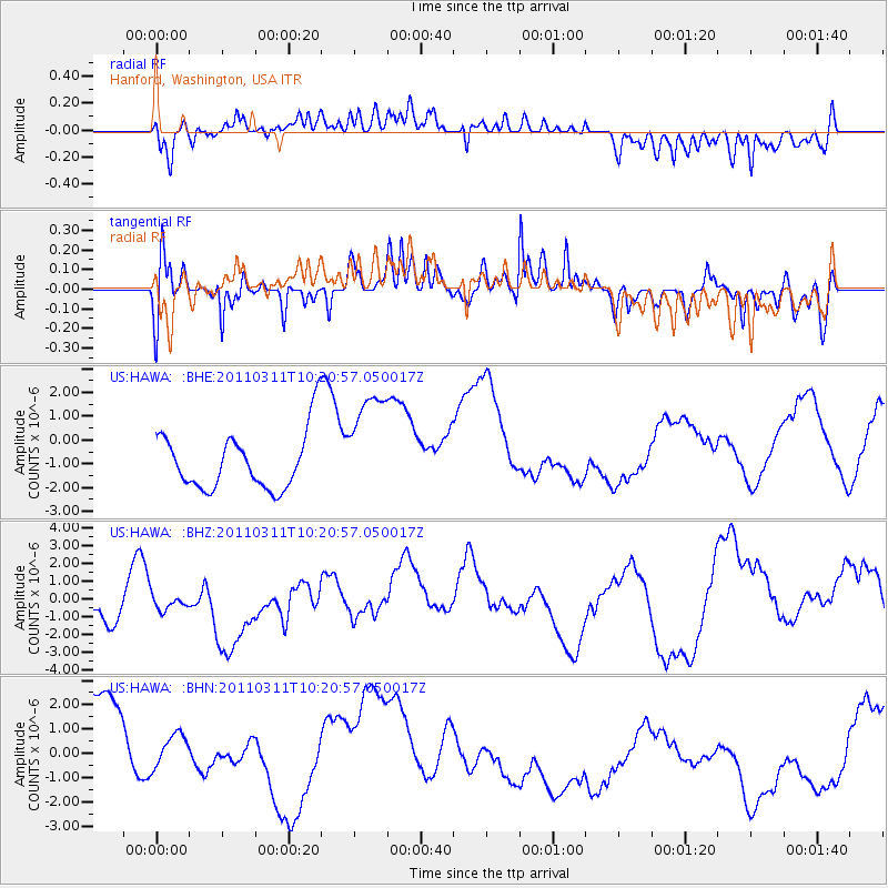
HAWA Hanford, Washington, USA - Earthquake Result Viewer
*The percent match for this event was below the threshold and hence no stack was calculated.
| Earthquake location: |
Near East Coast Of Honshu, Japan |
| Earthquake latitude/longitude: |
39.2/142.8 |
| Earthquake time(UTC): |
2011/03/11 (070) 10:10:34 GMT |
| Earthquake Depth: |
26 km |
| Earthquake Magnitude: |
6.0 MB |
| Earthquake Catalog/Contributor: |
WHDF/NEIC |
|
| Network: |
US United States National Seismic Network |
| Station: |
HAWA Hanford, Washington, USA |
| Lat/Lon: |
46.39 N/119.53 W |
| Elevation: |
364 m |
|
| Distance: |
67.5 deg |
| Az: |
47.918 deg |
| Baz: |
303.553 deg |
| Ray Param: |
$rayparam |
*The percent match for this event was below the threshold and hence was not used in the summary stack. |
|
| Radial Match: |
36.116047 % |
| Radial Bump: |
400 |
| Transverse Match: |
39.30472 % |
| Transverse Bump: |
397 |
| SOD ConfigId: |
356183 |
| Insert Time: |
2011-08-14 08:10:50.784 +0000 |
| GWidth: |
2.5 |
| Max Bumps: |
400 |
| Tol: |
0.001 |
|
Signal To Noise
| Channel | StoN | STA | LTA |
| US:HAWA: :BHZ:20110311T10:20:57.050017Z | 0.27952138 | 4.1556703E-7 | 1.4867093E-6 |
| US:HAWA: :BHN:20110311T10:20:57.050017Z | 0.40351075 | 6.815799E-7 | 1.6891244E-6 |
| US:HAWA: :BHE:20110311T10:20:57.050017Z | 1.919017 | 2.3365703E-6 | 1.2175872E-6 |
| Arrivals |
| Ps | |
| PpPs | |
| PsPs/PpSs | |


