You are here: Home > Network List > CI - Caltech Regional Seismic Network Stations List
> Station FUR Furnace Creek, CA, USA > Earthquake Result Viewer
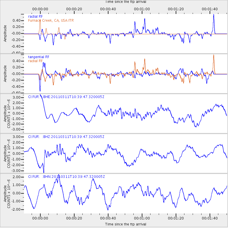
FUR Furnace Creek, CA, USA - Earthquake Result Viewer
*The percent match for this event was below the threshold and hence no stack was calculated.
| Earthquake location: |
Off East Coast Of Honshu, Japan |
| Earthquake latitude/longitude: |
39.4/143.6 |
| Earthquake time(UTC): |
2011/03/11 (070) 10:28:42 GMT |
| Earthquake Depth: |
20 km |
| Earthquake Magnitude: |
5.9 MB |
| Earthquake Catalog/Contributor: |
WHDF/NEIC |
|
| Network: |
CI Caltech Regional Seismic Network |
| Station: |
FUR Furnace Creek, CA, USA |
| Lat/Lon: |
36.47 N/116.86 W |
| Elevation: |
-37.0 m |
|
| Distance: |
74.3 deg |
| Az: |
55.662 deg |
| Baz: |
307.466 deg |
| Ray Param: |
$rayparam |
*The percent match for this event was below the threshold and hence was not used in the summary stack. |
|
| Radial Match: |
56.996906 % |
| Radial Bump: |
362 |
| Transverse Match: |
59.217407 % |
| Transverse Bump: |
400 |
| SOD ConfigId: |
356183 |
| Insert Time: |
2011-08-14 09:58:41.126 +0000 |
| GWidth: |
2.5 |
| Max Bumps: |
400 |
| Tol: |
0.001 |
|
Signal To Noise
| Channel | StoN | STA | LTA |
| CI:FUR: :BHZ:20110311T10:39:47.320005Z | 1.9353305 | 2.1388366E-6 | 1.1051532E-6 |
| CI:FUR: :BHN:20110311T10:39:47.320005Z | 1.089435 | 9.515461E-7 | 8.7343085E-7 |
| CI:FUR: :BHE:20110311T10:39:47.320005Z | 0.9257377 | 1.0034323E-6 | 1.0839273E-6 |
| Arrivals |
| Ps | |
| PpPs | |
| PsPs/PpSs | |


