You are here: Home > Network List > AZ - ANZA Regional Network Stations List
> Station LVA2 AZ.LVA2 > Earthquake Result Viewer
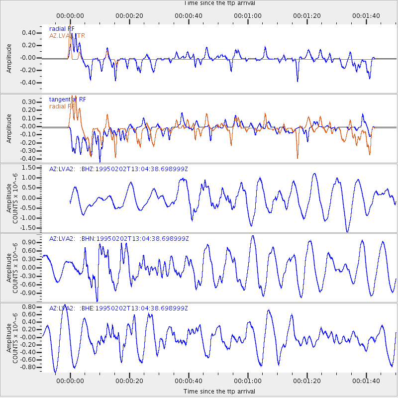
LVA2 AZ.LVA2 - Earthquake Result Viewer
*The percent match for this event was below the threshold and hence no stack was calculated.
| Earthquake location: |
Northern Mid-Atlantic Ridge |
| Earthquake latitude/longitude: |
10.8/-42.6 |
| Earthquake time(UTC): |
1995/02/02 (033) 12:53:53 GMT |
| Earthquake Depth: |
10 km |
| Earthquake Magnitude: |
5.6 MB, 5.4 MS, 5.8 UNKNOWN |
| Earthquake Catalog/Contributor: |
WHDF/NEIC |
|
| Network: |
AZ ANZA Regional Network |
| Station: |
LVA2 AZ.LVA2 |
| Lat/Lon: |
33.35 N/116.56 W |
| Elevation: |
1435 m |
|
| Distance: |
70.8 deg |
| Az: |
301.598 deg |
| Baz: |
89.575 deg |
| Ray Param: |
$rayparam |
*The percent match for this event was below the threshold and hence was not used in the summary stack. |
|
| Radial Match: |
70.64921 % |
| Radial Bump: |
400 |
| Transverse Match: |
55.242676 % |
| Transverse Bump: |
400 |
| SOD ConfigId: |
4480 |
| Insert Time: |
2010-02-26 19:52:35.967 +0000 |
| GWidth: |
2.5 |
| Max Bumps: |
400 |
| Tol: |
0.001 |
|
Signal To Noise
| Channel | StoN | STA | LTA |
| AZ:LVA2: :BHN:19950202T13:04:38.698999Z | 0.39357686 | 1.851296E-7 | 4.7037724E-7 |
| AZ:LVA2: :BHE:19950202T13:04:38.698999Z | 1.9222498 | 5.5014914E-7 | 2.8620065E-7 |
| AZ:LVA2: :BHZ:19950202T13:04:38.698999Z | 0.5553434 | 2.1450239E-7 | 3.862518E-7 |
| Arrivals |
| Ps | |
| PpPs | |
| PsPs/PpSs | |


