You are here: Home > Network List > TA - USArray Transportable Network (new EarthScope stations) Stations List
> Station 234A Clairette, TX, USA > Earthquake Result Viewer
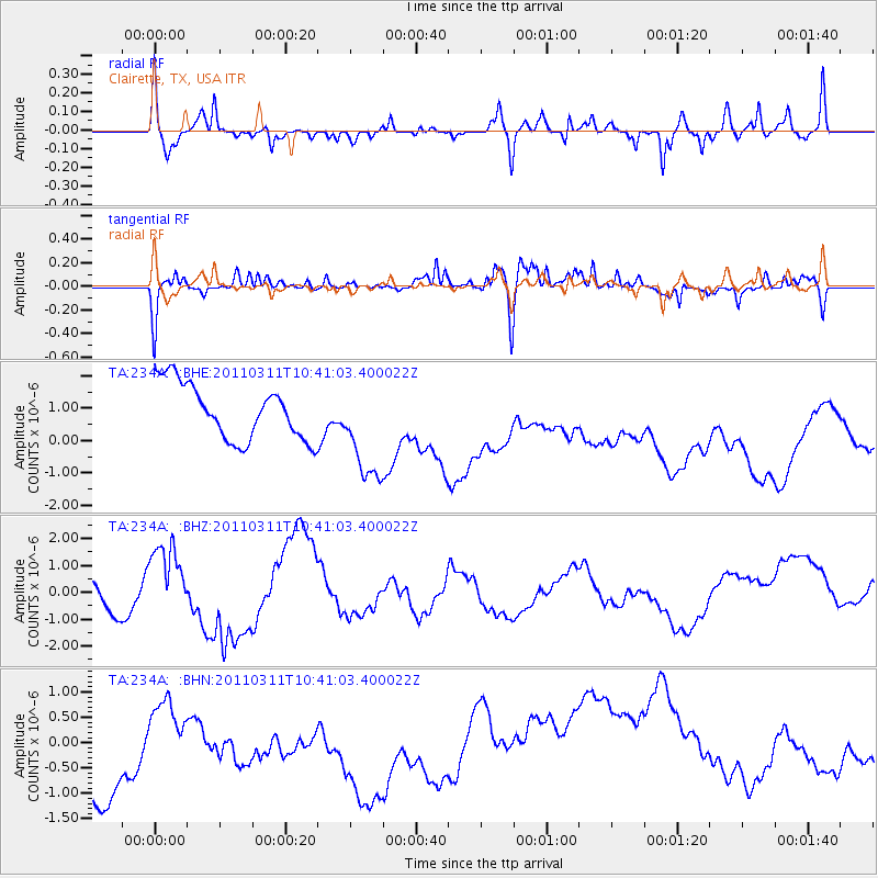
234A Clairette, TX, USA - Earthquake Result Viewer
*The percent match for this event was below the threshold and hence no stack was calculated.
| Earthquake location: |
Off East Coast Of Honshu, Japan |
| Earthquake latitude/longitude: |
39.4/143.6 |
| Earthquake time(UTC): |
2011/03/11 (070) 10:28:42 GMT |
| Earthquake Depth: |
20 km |
| Earthquake Magnitude: |
5.9 MB |
| Earthquake Catalog/Contributor: |
WHDF/NEIC |
|
| Network: |
TA USArray Transportable Network (new EarthScope stations) |
| Station: |
234A Clairette, TX, USA |
| Lat/Lon: |
32.00 N/98.14 W |
| Elevation: |
358 m |
|
| Distance: |
88.8 deg |
| Az: |
48.455 deg |
| Baz: |
316.954 deg |
| Ray Param: |
$rayparam |
*The percent match for this event was below the threshold and hence was not used in the summary stack. |
|
| Radial Match: |
57.477844 % |
| Radial Bump: |
359 |
| Transverse Match: |
55.933678 % |
| Transverse Bump: |
360 |
| SOD ConfigId: |
356183 |
| Insert Time: |
2011-08-14 11:09:01.363 +0000 |
| GWidth: |
2.5 |
| Max Bumps: |
400 |
| Tol: |
0.001 |
|
Signal To Noise
| Channel | StoN | STA | LTA |
| TA:234A: :BHZ:20110311T10:41:03.400022Z | 3.0199935 | 1.5481799E-6 | 5.126434E-7 |
| TA:234A: :BHN:20110311T10:41:03.400022Z | 0.2406652 | 4.890581E-7 | 2.0321097E-6 |
| TA:234A: :BHE:20110311T10:41:03.400022Z | 1.8588372 | 1.5877007E-6 | 8.541365E-7 |
| Arrivals |
| Ps | |
| PpPs | |
| PsPs/PpSs | |


