You are here: Home > Network List > TA - USArray Transportable Network (new EarthScope stations) Stations List
> Station P36A Good Intent, Atchison, KS, USA > Earthquake Result Viewer
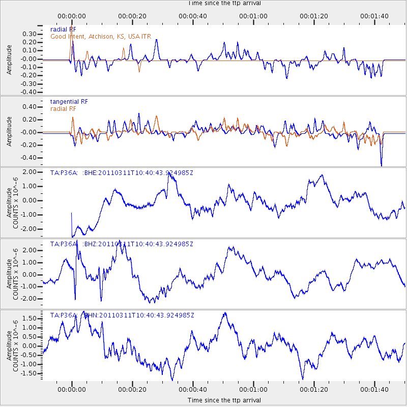
P36A Good Intent, Atchison, KS, USA - Earthquake Result Viewer
*The percent match for this event was below the threshold and hence no stack was calculated.
| Earthquake location: |
Off East Coast Of Honshu, Japan |
| Earthquake latitude/longitude: |
39.4/143.6 |
| Earthquake time(UTC): |
2011/03/11 (070) 10:28:42 GMT |
| Earthquake Depth: |
20 km |
| Earthquake Magnitude: |
5.9 MB |
| Earthquake Catalog/Contributor: |
WHDF/NEIC |
|
| Network: |
TA USArray Transportable Network (new EarthScope stations) |
| Station: |
P36A Good Intent, Atchison, KS, USA |
| Lat/Lon: |
39.62 N/95.21 W |
| Elevation: |
313 m |
|
| Distance: |
84.8 deg |
| Az: |
41.563 deg |
| Baz: |
318.275 deg |
| Ray Param: |
$rayparam |
*The percent match for this event was below the threshold and hence was not used in the summary stack. |
|
| Radial Match: |
71.69778 % |
| Radial Bump: |
400 |
| Transverse Match: |
60.14241 % |
| Transverse Bump: |
400 |
| SOD ConfigId: |
356183 |
| Insert Time: |
2011-08-14 11:22:09.915 +0000 |
| GWidth: |
2.5 |
| Max Bumps: |
400 |
| Tol: |
0.001 |
|
Signal To Noise
| Channel | StoN | STA | LTA |
| TA:P36A: :BHZ:20110311T10:40:43.924985Z | 1.363032 | 1.2857464E-6 | 9.4329874E-7 |
| TA:P36A: :BHN:20110311T10:40:43.924985Z | 2.1970603 | 1.9636805E-6 | 8.937763E-7 |
| TA:P36A: :BHE:20110311T10:40:43.924985Z | 2.007032 | 1.9888519E-6 | 9.909418E-7 |
| Arrivals |
| Ps | |
| PpPs | |
| PsPs/PpSs | |


