You are here: Home > Network List > UW - Pacific Northwest Regional Seismic Network Stations List
> Station MRBL Marblemount, WA, USA > Earthquake Result Viewer
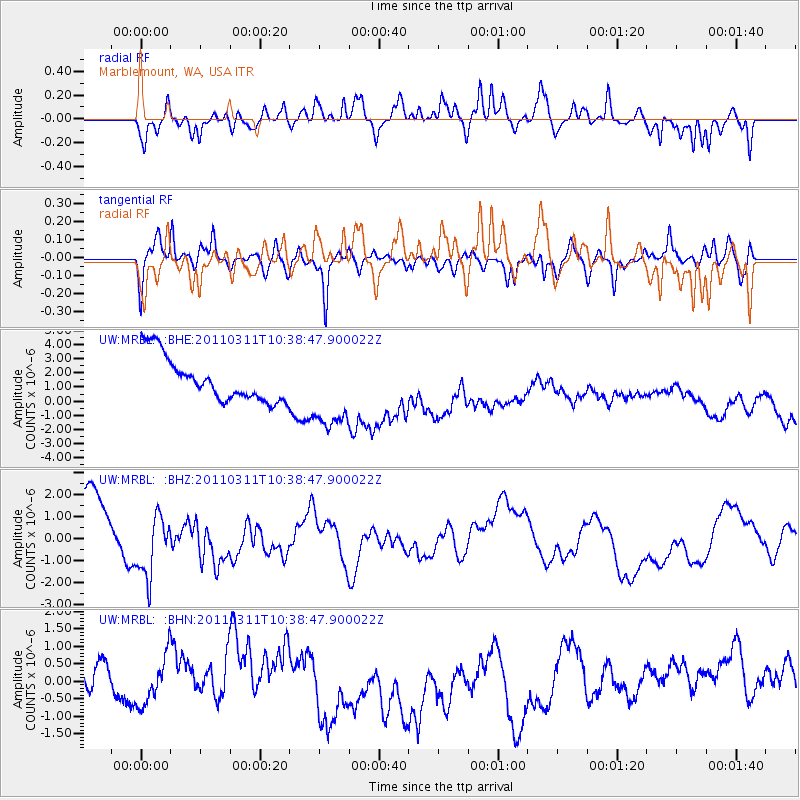
MRBL Marblemount, WA, USA - Earthquake Result Viewer
*The percent match for this event was below the threshold and hence no stack was calculated.
| Earthquake location: |
Off East Coast Of Honshu, Japan |
| Earthquake latitude/longitude: |
39.4/143.6 |
| Earthquake time(UTC): |
2011/03/11 (070) 10:28:42 GMT |
| Earthquake Depth: |
20 km |
| Earthquake Magnitude: |
5.9 MB |
| Earthquake Catalog/Contributor: |
WHDF/NEIC |
|
| Network: |
UW Pacific Northwest Regional Seismic Network |
| Station: |
MRBL Marblemount, WA, USA |
| Lat/Lon: |
48.52 N/121.48 W |
| Elevation: |
75 m |
|
| Distance: |
64.7 deg |
| Az: |
47.133 deg |
| Baz: |
301.332 deg |
| Ray Param: |
$rayparam |
*The percent match for this event was below the threshold and hence was not used in the summary stack. |
|
| Radial Match: |
59.501457 % |
| Radial Bump: |
400 |
| Transverse Match: |
66.7542 % |
| Transverse Bump: |
400 |
| SOD ConfigId: |
356183 |
| Insert Time: |
2011-08-14 12:07:04.461 +0000 |
| GWidth: |
2.5 |
| Max Bumps: |
400 |
| Tol: |
0.001 |
|
Signal To Noise
| Channel | StoN | STA | LTA |
| UW:MRBL: :BHZ:20110311T10:38:47.900022Z | 1.2592639 | 1.4331248E-6 | 1.1380656E-6 |
| UW:MRBL: :BHN:20110311T10:38:47.900022Z | 0.8588543 | 6.7940573E-7 | 7.910605E-7 |
| UW:MRBL: :BHE:20110311T10:38:47.900022Z | 1.7670624 | 2.7692083E-6 | 1.5671253E-6 |
| Arrivals |
| Ps | |
| PpPs | |
| PsPs/PpSs | |


