You are here: Home > Network List > TA - USArray Transportable Network (new EarthScope stations) Stations List
> Station A26A Wade Farm, Kenmare, ND, USA > Earthquake Result Viewer
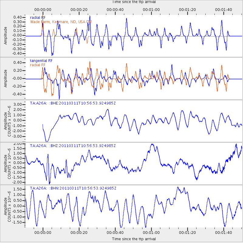
A26A Wade Farm, Kenmare, ND, USA - Earthquake Result Viewer
*The percent match for this event was below the threshold and hence no stack was calculated.
| Earthquake location: |
Off East Coast Of Honshu, Japan |
| Earthquake latitude/longitude: |
38.4/143.8 |
| Earthquake time(UTC): |
2011/03/11 (070) 10:45:44 GMT |
| Earthquake Depth: |
33 km |
| Earthquake Magnitude: |
5.6 MB |
| Earthquake Catalog/Contributor: |
WHDF/NEIC |
|
| Network: |
TA USArray Transportable Network (new EarthScope stations) |
| Station: |
A26A Wade Farm, Kenmare, ND, USA |
| Lat/Lon: |
48.90 N/102.04 W |
| Elevation: |
570 m |
|
| Distance: |
75.4 deg |
| Az: |
38.463 deg |
| Baz: |
312.234 deg |
| Ray Param: |
$rayparam |
*The percent match for this event was below the threshold and hence was not used in the summary stack. |
|
| Radial Match: |
43.39831 % |
| Radial Bump: |
400 |
| Transverse Match: |
51.30129 % |
| Transverse Bump: |
400 |
| SOD ConfigId: |
356183 |
| Insert Time: |
2011-08-14 13:19:09.177 +0000 |
| GWidth: |
2.5 |
| Max Bumps: |
400 |
| Tol: |
0.001 |
|
Signal To Noise
| Channel | StoN | STA | LTA |
| TA:A26A: :BHZ:20110311T10:56:53.924985Z | 3.2485642 | 1.3815306E-6 | 4.2527427E-7 |
| TA:A26A: :BHN:20110311T10:56:53.924985Z | 0.93526113 | 6.906699E-7 | 7.384781E-7 |
| TA:A26A: :BHE:20110311T10:56:53.924985Z | 0.7072356 | 1.0452079E-6 | 1.4778781E-6 |
| Arrivals |
| Ps | |
| PpPs | |
| PsPs/PpSs | |


