You are here: Home > Network List > AZ - ANZA Regional Network Stations List
> Station LVA2 AZ.LVA2 > Earthquake Result Viewer
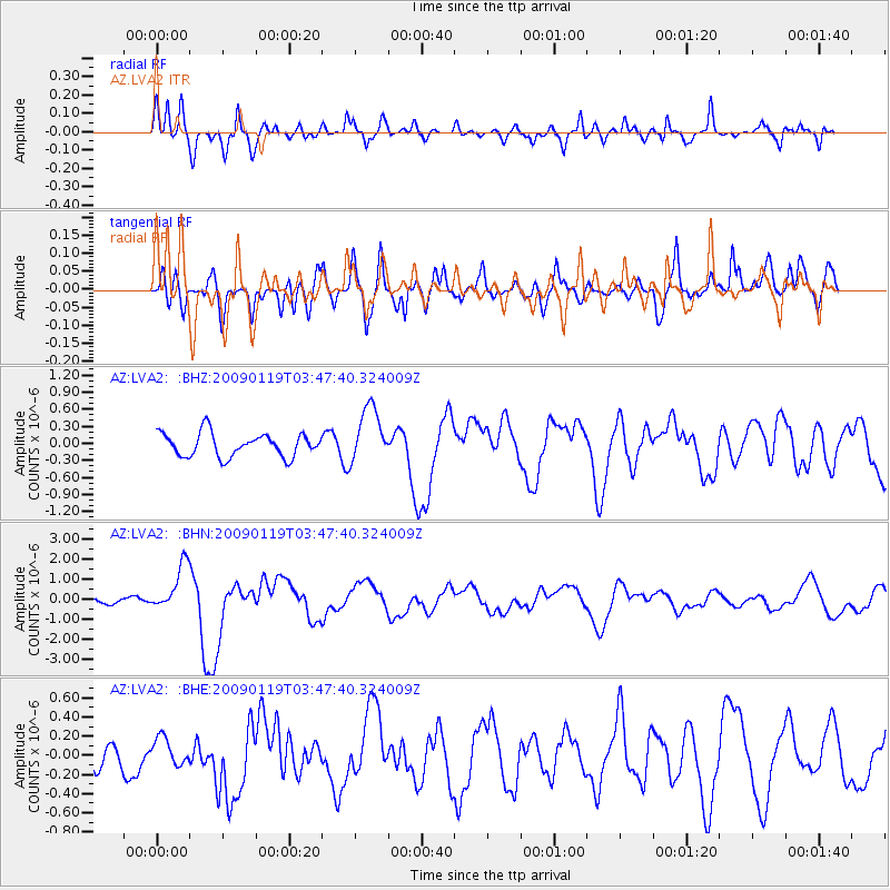
LVA2 AZ.LVA2 - Earthquake Result Viewer
*The percent match for this event was below the threshold and hence no stack was calculated.
| Earthquake location: |
Southeast Of Loyalty Islands |
| Earthquake latitude/longitude: |
-22.6/170.9 |
| Earthquake time(UTC): |
2009/01/19 (019) 03:35:18 GMT |
| Earthquake Depth: |
12 km |
| Earthquake Magnitude: |
5.7 MB, 6.4 MS, 6.5 MW, 6.5 MW |
| Earthquake Catalog/Contributor: |
WHDF/NEIC |
|
| Network: |
AZ ANZA Regional Network |
| Station: |
LVA2 AZ.LVA2 |
| Lat/Lon: |
33.35 N/116.56 W |
| Elevation: |
1435 m |
|
| Distance: |
88.7 deg |
| Az: |
52.997 deg |
| Baz: |
241.854 deg |
| Ray Param: |
$rayparam |
*The percent match for this event was below the threshold and hence was not used in the summary stack. |
|
| Radial Match: |
74.90388 % |
| Radial Bump: |
400 |
| Transverse Match: |
76.72293 % |
| Transverse Bump: |
400 |
| SOD ConfigId: |
2658 |
| Insert Time: |
2010-02-26 19:53:37.601 +0000 |
| GWidth: |
2.5 |
| Max Bumps: |
400 |
| Tol: |
0.001 |
|
Signal To Noise
| Channel | StoN | STA | LTA |
| AZ:LVA2: :BHN:20090119T03:47:40.324009Z | 3.5788739 | 1.1707183E-6 | 3.2711918E-7 |
| AZ:LVA2: :BHE:20090119T03:47:40.324009Z | 0.8763054 | 1.3779014E-7 | 1.5723985E-7 |
| AZ:LVA2: :BHZ:20090119T03:47:40.324009Z | 2.3972228 | 4.9300957E-7 | 2.0565864E-7 |
| Arrivals |
| Ps | |
| PpPs | |
| PsPs/PpSs | |


