You are here: Home > Network List > TA - USArray Transportable Network (new EarthScope stations) Stations List
> Station V32A Arapaho, OK, USA > Earthquake Result Viewer
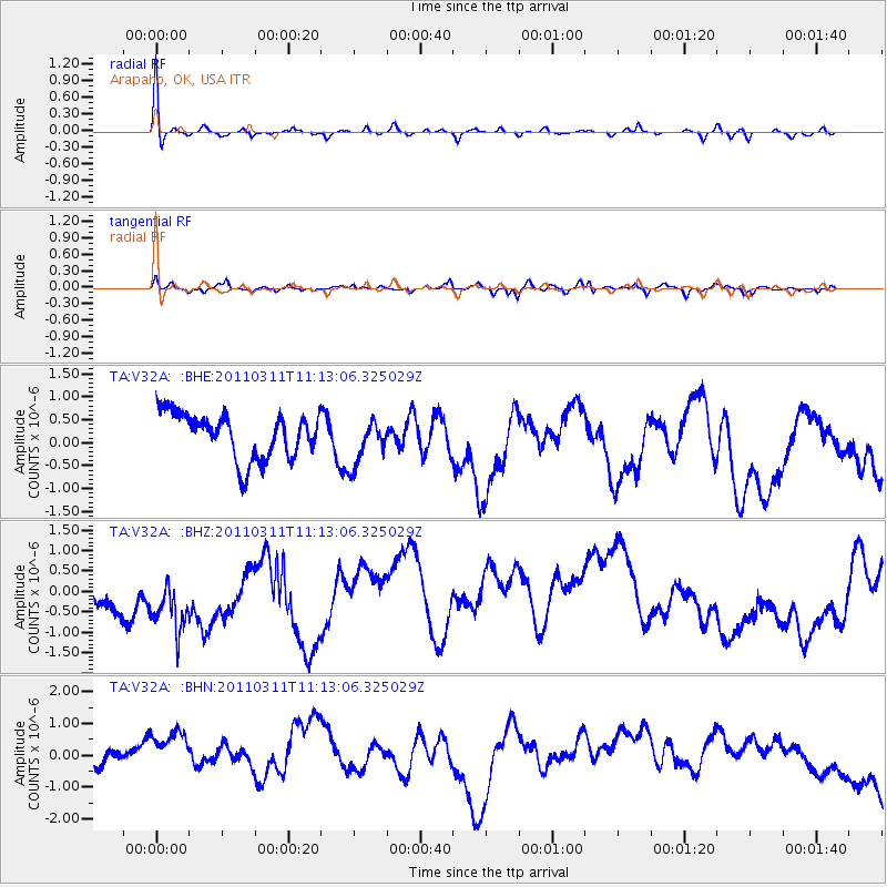
V32A Arapaho, OK, USA - Earthquake Result Viewer
*The percent match for this event was below the threshold and hence no stack was calculated.
| Earthquake location: |
Near East Coast Of Honshu, Japan |
| Earthquake latitude/longitude: |
37.7/141.5 |
| Earthquake time(UTC): |
2011/03/11 (070) 11:00:52 GMT |
| Earthquake Depth: |
42 km |
| Earthquake Magnitude: |
5.6 MB |
| Earthquake Catalog/Contributor: |
WHDF/NEIC |
|
| Network: |
TA USArray Transportable Network (new EarthScope stations) |
| Station: |
V32A Arapaho, OK, USA |
| Lat/Lon: |
35.72 N/99.04 W |
| Elevation: |
533 m |
|
| Distance: |
87.9 deg |
| Az: |
45.153 deg |
| Baz: |
316.309 deg |
| Ray Param: |
$rayparam |
*The percent match for this event was below the threshold and hence was not used in the summary stack. |
|
| Radial Match: |
73.62607 % |
| Radial Bump: |
319 |
| Transverse Match: |
69.013725 % |
| Transverse Bump: |
400 |
| SOD ConfigId: |
356183 |
| Insert Time: |
2011-08-14 15:53:17.204 +0000 |
| GWidth: |
2.5 |
| Max Bumps: |
400 |
| Tol: |
0.001 |
|
Signal To Noise
| Channel | StoN | STA | LTA |
| TA:V32A: :BHZ:20110311T11:13:06.325029Z | 1.1257317 | 1.4871929E-6 | 1.3210899E-6 |
| TA:V32A: :BHN:20110311T11:13:06.325029Z | 1.4358124 | 1.734377E-6 | 1.2079412E-6 |
| TA:V32A: :BHE:20110311T11:13:06.325029Z | 1.0001576 | 4.9674094E-7 | 4.9666266E-7 |
| Arrivals |
| Ps | |
| PpPs | |
| PsPs/PpSs | |


