You are here: Home > Network List > TA - USArray Transportable Network (new EarthScope stations) Stations List
> Station P57A Homestead Farm, Martinsburg, WV, USA > Earthquake Result Viewer
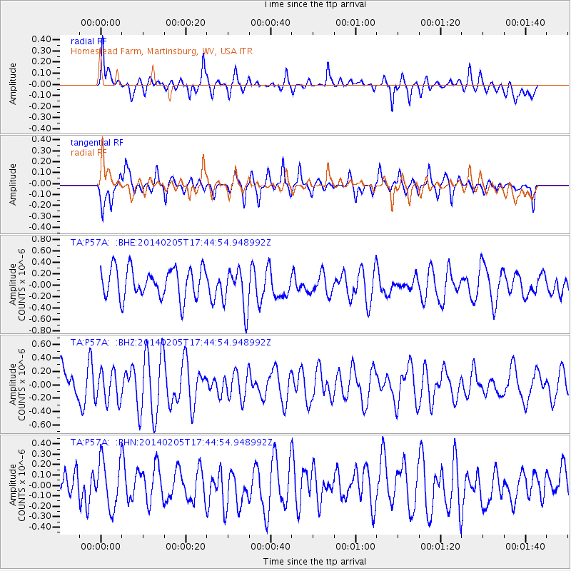
P57A Homestead Farm, Martinsburg, WV, USA - Earthquake Result Viewer
*The percent match for this event was below the threshold and hence no stack was calculated.
| Earthquake location: |
Near East Coast Of Honshu, Japan |
| Earthquake latitude/longitude: |
38.7/142.4 |
| Earthquake time(UTC): |
2014/02/05 (036) 17:32:13 GMT |
| Earthquake Depth: |
46 km |
| Earthquake Magnitude: |
5.3 MW |
| Earthquake Catalog/Contributor: |
ISC/ISC |
|
| Network: |
TA USArray Transportable Network (new EarthScope stations) |
| Station: |
P57A Homestead Farm, Martinsburg, WV, USA |
| Lat/Lon: |
39.48 N/78.01 W |
| Elevation: |
191 m |
|
| Distance: |
93.8 deg |
| Az: |
30.155 deg |
| Baz: |
329.474 deg |
| Ray Param: |
$rayparam |
*The percent match for this event was below the threshold and hence was not used in the summary stack. |
|
| Radial Match: |
58.996567 % |
| Radial Bump: |
400 |
| Transverse Match: |
50.44976 % |
| Transverse Bump: |
363 |
| SOD ConfigId: |
3390531 |
| Insert Time: |
2019-04-10 06:05:18.816 +0000 |
| GWidth: |
2.5 |
| Max Bumps: |
400 |
| Tol: |
0.001 |
|
Signal To Noise
| Channel | StoN | STA | LTA |
| TA:P57A: :BHZ:20140205T17:44:54.948992Z | 0.94431937 | 2.3012836E-7 | 2.436976E-7 |
| TA:P57A: :BHN:20140205T17:44:54.948992Z | 1.4018457 | 2.3767738E-7 | 1.6954604E-7 |
| TA:P57A: :BHE:20140205T17:44:54.948992Z | 1.4670824 | 3.7611977E-7 | 2.5637263E-7 |
| Arrivals |
| Ps | |
| PpPs | |
| PsPs/PpSs | |


